Where is Rosebud County, Montana?
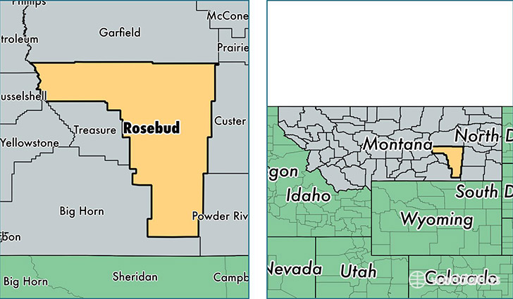
Rosebud County is a county equivalent area found in Montana, USA. The county government of Rosebud is found in the county seat of Forsyth.
With a total 13,019.68 sq. km of land and water area, Rosebud County, Montana is the 83rd largest county equivalent area in the United States. Home to 9,326 people, Rosebud County has a total 4093 households earning 48789 on average per year.
Rosebud County, Montana - Quick Facts
| FIPS Code | 30087 |
| Area Codes | 406 |
| Time Zone | MST |
| Major Cities | Lame Deer (population: 3,000), Forsyth (population: 2,996), Colstrip (population: 2,334), Ashland (population: 1,179), Rosebud (population: 326), Birney (population: 253), Ingomar (population: 28), Hathaway (population: 21) |
| Land Area | 3,601 sq miles |
| Water Area | 5,010 sq miles |
| Household Income | $48,789 |
| Housing Units | 4,093 |
| Median Home Value | $110,900 |
| High School Grads | 89% of population |
| Holders of Bachelors Degrees | 22% of population |
| Retail Spending | $5,847 per capita |
| Food & Accomodation Sales | $9,014 per capita |
| Universities and Colleges | Chief Dull Knife College |
This page was last updated on June 30, 2016.