Where is Tishomingo County, Mississippi?
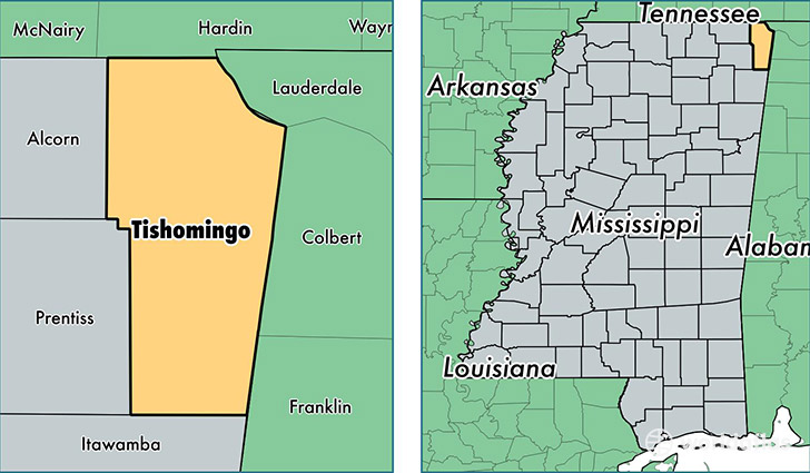
Tishomingo County is a county equivalent area found in Mississippi, USA. The county government of Tishomingo is found in the county seat of Iuka.
With a total 1,151.3 sq. km of land and water area, Tishomingo County, Mississippi is the 2364th largest county equivalent area in the United States. Home to 19,420 people, Tishomingo County has a total 10259 households earning 32592 on average per year.
Tishomingo County, Mississippi - Quick Facts
| FIPS Code | 28141 |
| Area Codes | 662 |
| Time Zone | CST |
| Major Cities | Iuka (population: 9,448), Belmont (population: 2,732), Tishomingo (population: 2,719), Burnsville (population: 2,370), Dennis (population: 1,628) |
| Land Area | 7,498 sq miles |
| Water Area | 424 sq miles |
| Household Income | $32,592 |
| Housing Units | 10,259 |
| Median Home Value | $72,900 |
| High School Grads | 77% of population |
| Holders of Bachelors Degrees | 11% of population |
| Retail Spending | $5,867 per capita |
| Food & Accomodation Sales | $9,168 per capita |
This page was last updated on June 30, 2016.