Where is Lawrence County, Mississippi?
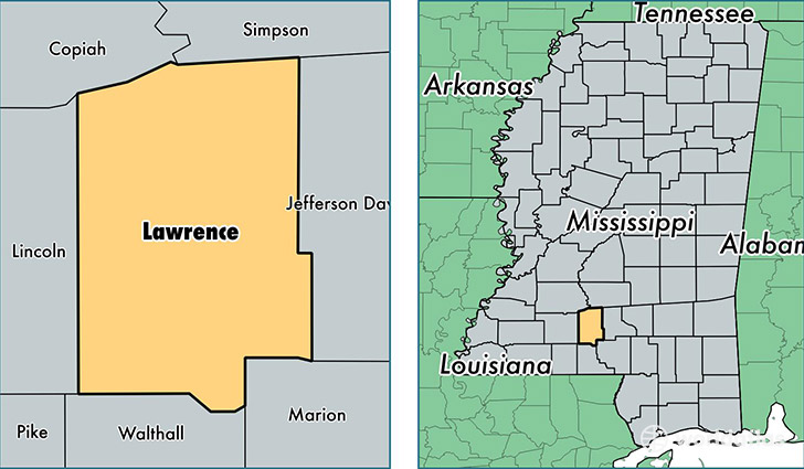
Lawrence County is a county equivalent area found in Mississippi, USA. The county government of Lawrence is found in the county seat of Monticello.
With a total 1,128.64 sq. km of land and water area, Lawrence County, Mississippi is the 2411th largest county equivalent area in the United States. Home to 12,502 people, Lawrence County has a total 5989 households earning 38393 on average per year.
Lawrence County, Mississippi - Quick Facts
| FIPS Code | 28077 |
| Area Codes | 601 |
| Time Zone | CST |
| Major Cities | Monticello (population: 5,470), Jayess (population: 4,461), Silver Creek (population: 2,987), Newhebron (population: 2,187), Sontag (population: 1,168) |
| Land Area | 4,827 sq miles |
| Water Area | 431 sq miles |
| Household Income | $38,393 |
| Housing Units | 5,989 |
| Median Home Value | $79,600 |
| High School Grads | 82% of population |
| Holders of Bachelors Degrees | 13% of population |
| Retail Spending | $3,530 per capita |
| Food & Accomodation Sales | $4,008 per capita |
This page was last updated on June 30, 2016.