Where is DeSoto County, Mississippi?
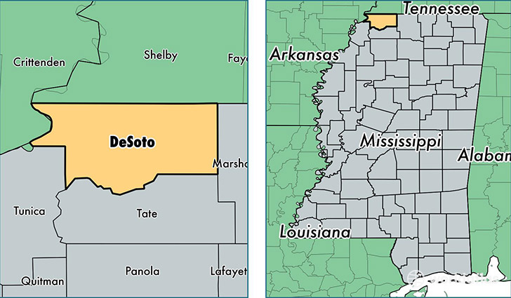
DeSoto County is a county equivalent area found in Mississippi, USA. The county government of DeSoto is found in the county seat of Hernando.
With a total 1,287.18 sq. km of land and water area, DeSoto County, Mississippi is the 2197th largest county equivalent area in the United States. Home to 170,913 people, DeSoto County has a total 63018 households earning 58505 on average per year.
DeSoto County, Mississippi - Quick Facts
| FIPS Code | 28033 |
| Area Codes | 662 |
| Time Zone | CST |
| Major Cities | Southaven (population: 48,411), Olive Branch (population: 47,364), Horn Lake (population: 26,871), Hernando (population: 25,130), Nesbit (population: 7,322), Walls (population: 6,385), Lake Cormorant (population: 2,410) |
| Land Area | 65,990 sq miles |
| Water Area | 476 sq miles |
| Household Income | $58,505 |
| Housing Units | 63,018 |
| Median Home Value | $152,600 |
| High School Grads | 89% of population |
| Holders of Bachelors Degrees | 22% of population |
| Retail Spending | $13,825 per capita |
| Food & Accomodation Sales | $256,752 per capita |
This page was last updated on June 30, 2016.