Where is Ozark County, Missouri?
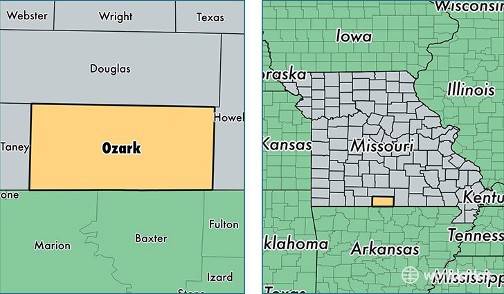
Ozark County is a county equivalent area found in Missouri, USA. The county government of Ozark is found in the county seat of Gainesville.
With a total 1,956.04 sq. km of land and water area, Ozark County, Missouri is the 1269th largest county equivalent area in the United States. Home to 9,492 people, Ozark County has a total 5585 households earning 32078 on average per year.
Ozark County, Missouri - Quick Facts
| FIPS Code | 29153 |
| Area Codes | 417 |
| Time Zone | CST |
| Major Cities | Gainesville (population: 3,146), Caulfield (population: 1,631), Theodosia (population: 1,260), Dora (population: 1,125), Bakersfield (population: 771), Tecumseh (population: 729), Wasola (population: 702), Squires (population: 514), Isabella (population: 466), Thornfield (population: 435) |
| Land Area | 3,665 sq miles |
| Water Area | 745 sq miles |
| Household Income | $32,078 |
| Housing Units | 5,585 |
| Median Home Value | $89,900 |
| High School Grads | 83% of population |
| Holders of Bachelors Degrees | 13% of population |
| Retail Spending | $4,913 per capita |
| Food & Accomodation Sales | $6,403 per capita |
This page was last updated on June 30, 2016.