Where is Washington County, Maryland?
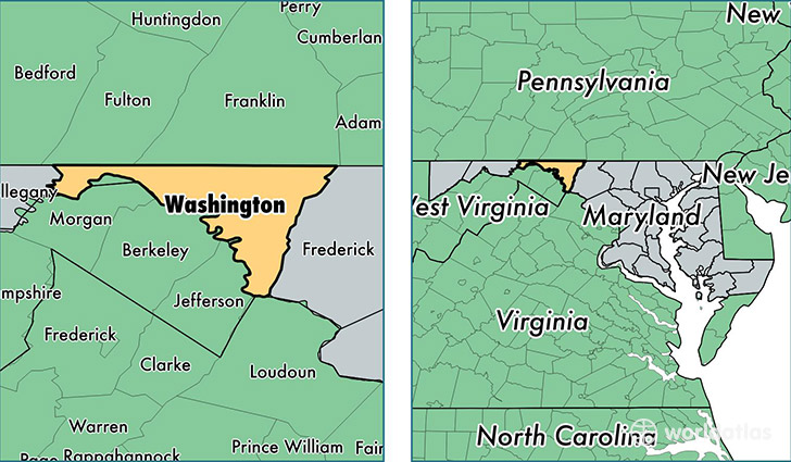
Washington County is a county equivalent area found in Maryland, USA. The county government of Washington is found in the county seat of Hagerstown.
With a total 1,210.41 sq. km of land and water area, Washington County, Maryland is the 2292nd largest county equivalent area in the United States. Home to 149,573 people, Washington County has a total 60830 households earning 55609 on average per year.
Washington County, Maryland offers the following attractions to visitors: Antietam National Cemetery NHS, Antietam NBS, Harpers Ferry NHP
Washington County, Maryland - Quick Facts
| FIPS Code | 24043 |
| Area Codes | 301 |
| Time Zone | EST |
| Major Cities | Hagerstown (population: 96,315), Boonsboro (population: 9,614), Williamsport (population: 9,342), Smithsburg (population: 9,255), Clear Spring (population: 5,610), Sharpsburg (population: 4,145), Hancock (population: 3,810), Keedysville (population: 3,654), Cascade (population: 1,566), Fairplay (population: 1,176) |
| Land Area | 57,750 sq miles |
| Water Area | 458 sq miles |
| Household Income | $55,609 |
| Housing Units | 60,830 |
| Median Home Value | $206,100 |
| High School Grads | 86% of population |
| Holders of Bachelors Degrees | 20% of population |
| Retail Spending | $16,988 per capita |
| Food & Accomodation Sales | $229,661 per capita |
This page was last updated on June 30, 2016.