Where is Magoffin County, Kentucky?
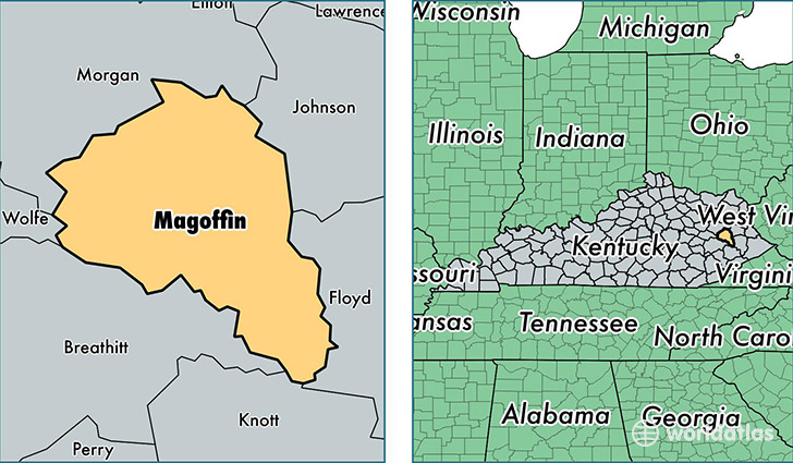
Magoffin County is a county equivalent area found in Kentucky, USA. The county government of Magoffin is found in the county seat of Salyersville.
With a total 800.71 sq. km of land and water area, Magoffin County, Kentucky is the 2828th largest county equivalent area in the United States. Home to 12,913 people, Magoffin County has a total 5878 households earning 26877 on average per year.
Magoffin County, Kentucky - Quick Facts
| FIPS Code | 21153 |
| Area Codes | 606 |
| Time Zone | EST |
| Major Cities | Salyersville (population: 11,716), Royalton (population: 706), Gunlock (population: 600), Falcon (population: 96) |
| Land Area | 4,986 sq miles |
| Water Area | 308 sq miles |
| Household Income | $26,877 |
| Housing Units | 5,878 |
| Median Home Value | $43,700 |
| High School Grads | 66% of population |
| Holders of Bachelors Degrees | 9% of population |
| Retail Spending | $4,022 per capita |
| Food & Accomodation Sales | $7,290 per capita |
This page was last updated on June 30, 2016.