Where is Henry County, Kentucky?
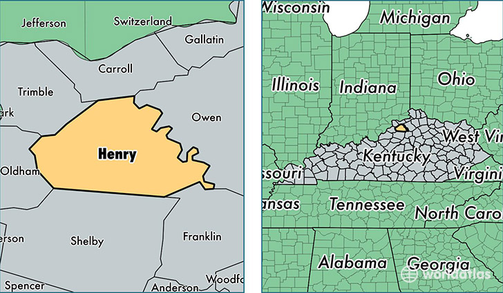
Henry County is a county equivalent area found in Kentucky, USA. The county government of Henry is found in the county seat of New Castle.
With a total 754. sq. km of land and water area, Henry County, Kentucky is the 2858th largest county equivalent area in the United States. Home to 15,572 people, Henry County has a total 6625 households earning 46016 on average per year.
Henry County, Kentucky - Quick Facts
| FIPS Code | 21103 |
| Area Codes | 502 |
| Time Zone | EST |
| Major Cities | Eminence (population: 3,772), Pleasureville (population: 3,367), Campbellsburg (population: 2,536), Smithfield (population: 2,126), Pendleton (population: 1,751), New Castle (population: 1,380), Turners Station (population: 1,317), Sulphur (population: 578), Lockport (population: 221), Bethlehem (population: 164) |
| Land Area | 6,012 sq miles |
| Water Area | 286 sq miles |
| Household Income | $46,016 |
| Housing Units | 6,625 |
| Median Home Value | $123,300 |
| High School Grads | 80% of population |
| Holders of Bachelors Degrees | 13% of population |
| Retail Spending | $9,689 per capita |
This page was last updated on June 30, 2016.