Where is Madison County, Indiana?
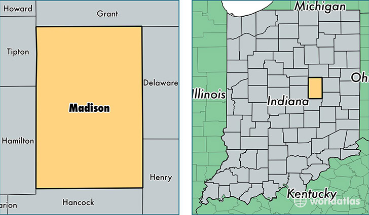
Madison County is a county equivalent area found in Indiana, USA. The county government of Madison is found in the county seat of Anderson.
With a total 1,173.02 sq. km of land and water area, Madison County, Indiana is the 2333rd largest county equivalent area in the United States. Home to 130,069 people, Madison County has a total 58642 households earning 43120 on average per year.
Madison County, Indiana - Quick Facts
| FIPS Code | 18095 |
| Area Codes | 765 |
| Time Zone | EST |
| Major Cities | Anderson (population: 78,533), Pendleton (population: 16,988), Elwood (population: 11,544), Alexandria (population: 10,357), Frankton (population: 2,935), Lapel (population: 2,798), Ingalls (population: 2,382), Summitville (population: 2,327), Markleville (population: 2,226), Orestes (population: 397) |
| Land Area | 50,220 sq miles |
| Water Area | 452 sq miles |
| Household Income | $43,120 |
| Housing Units | 58,642 |
| Median Home Value | $92,800 |
| High School Grads | 87% of population |
| Holders of Bachelors Degrees | 17% of population |
| Retail Spending | $9,433 per capita |
| Food & Accomodation Sales | $155,130 per capita |
This page was last updated on June 30, 2016.