Where is Lagrange County, Indiana?
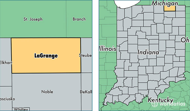
Lagrange County is a county equivalent area found in Indiana, USA. The county government of Lagrange is found in the county seat of Lagrange.
With a total 1,001.56 sq. km of land and water area, Lagrange County, Indiana is the 2644th largest county equivalent area in the United States. Home to 38,436 people, Lagrange County has a total 14236 households earning 47617 on average per year.
Lagrange County, Indiana - Quick Facts
| FIPS Code | 18087 |
| Area Codes | 260 |
| Time Zone | EST |
| Major Cities | Lagrange (population: 12,163), Shipshewana (population: 8,034), Wolcottville (population: 5,659), Topeka (population: 5,589), Howe (population: 4,078), Mongo (population: 106), South Milford (population: 103) |
| Land Area | 14,840 sq miles |
| Water Area | 380 sq miles |
| Household Income | $47,617 |
| Housing Units | 14,236 |
| Median Home Value | $160,200 |
| High School Grads | 62% of population |
| Holders of Bachelors Degrees | 10% of population |
| Retail Spending | $7,498 per capita |
| Food & Accomodation Sales | $33,861 per capita |
This page was last updated on June 30, 2016.