Where is Jennings County, Indiana?
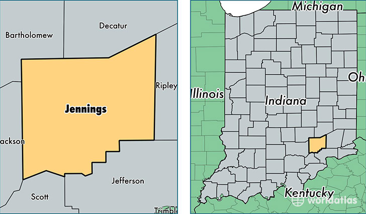
Jennings County is a county equivalent area found in Indiana, USA. The county government of Jennings is found in the county seat of Vernon.
With a total 979.91 sq. km of land and water area, Jennings County, Indiana is the 2663rd largest county equivalent area in the United States. Home to 28,000 people, Jennings County has a total 11980 households earning 44128 on average per year.
Jennings County, Indiana - Quick Facts
| FIPS Code | 18079 |
| Area Codes | 812 |
| Time Zone | EST |
| Major Cities | North Vernon (population: 20,644), Scipio (population: 1,825), Commiskey (population: 1,581), Butlerville (population: 1,470), Paris Crossing (population: 797), Vernon (population: 285) |
| Land Area | 10,811 sq miles |
| Water Area | 376 sq miles |
| Household Income | $44,128 |
| Housing Units | 11,980 |
| Median Home Value | $89,700 |
| High School Grads | 85% of population |
| Holders of Bachelors Degrees | 10% of population |
| Retail Spending | $7,956 per capita |
| Food & Accomodation Sales | $16,079 per capita |
This page was last updated on June 30, 2016.