Where is Jasper County, Indiana?
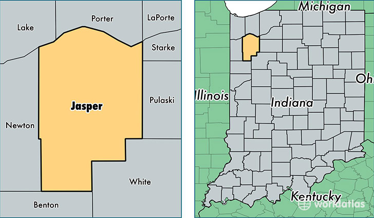
Jasper County is a county equivalent area found in Indiana, USA. The county government of Jasper is found in the county seat of Rensselaer.
With a total 1,453.99 sq. km of land and water area, Jasper County, Indiana is the 1970th largest county equivalent area in the United States. Home to 33,475 people, Jasper County has a total 13279 households earning 57500 on average per year.
Jasper County, Indiana - Quick Facts
| FIPS Code | 18073 |
| Area Codes | 219 |
| Time Zone | CST |
| Major Cities | Demotte (population: 13,514), Rensselaer (population: 11,784), Wheatfield (population: 7,951), Remington (population: 2,203), Fair Oaks (population: 928) |
| Land Area | 12,925 sq miles |
| Water Area | 559 sq miles |
| Household Income | $57,500 |
| Housing Units | 13,279 |
| Median Home Value | $146,200 |
| High School Grads | 87% of population |
| Holders of Bachelors Degrees | 15% of population |
| Retail Spending | $12,531 per capita |
| Food & Accomodation Sales | $33,940 per capita |
| Universities and Colleges | Saint Josephs College |
This page was last updated on June 30, 2016.