Where is Greene County, Indiana?
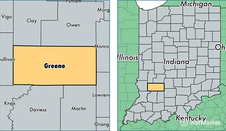
Greene County is a county equivalent area found in Indiana, USA. The county government of Greene is found in the county seat of Bloomfield.
With a total 1,413.92 sq. km of land and water area, Greene County, Indiana is the 2017th largest county equivalent area in the United States. Home to 32,726 people, Greene County has a total 15003 households earning 43980 on average per year.
Greene County, Indiana - Quick Facts
| FIPS Code | 18055 |
| Area Codes | 812 |
| Time Zone | EST |
| Major Cities | Bloomfield (population: 9,460), Linton (population: 9,206), Jasonville (population: 4,769), Solsberry (population: 3,768), Worthington (population: 2,707), Lyons (population: 1,224), Switz City (population: 744), Owensburg (population: 494), Newberry (population: 410), Scotland (population: 133) |
| Land Area | 12,636 sq miles |
| Water Area | 542 sq miles |
| Household Income | $43,980 |
| Housing Units | 15,003 |
| Median Home Value | $88,800 |
| High School Grads | 85% of population |
| Holders of Bachelors Degrees | 12% of population |
| Retail Spending | $6,924 per capita |
| Food & Accomodation Sales | $19,511 per capita |
This page was last updated on June 30, 2016.