Where is Grant County, Indiana?
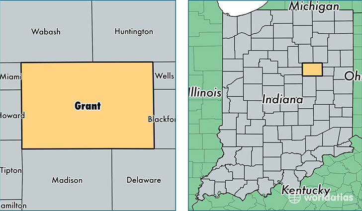
Grant County is a county equivalent area found in Indiana, USA. The county government of Grant is found in the county seat of Marion.
With a total 1,074.59 sq. km of land and water area, Grant County, Indiana is the 2515th largest county equivalent area in the United States. Home to 68,569 people, Grant County has a total 30211 households earning 39747 on average per year.
Grant County, Indiana - Quick Facts
| FIPS Code | 18053 |
| Area Codes | 765 |
| Time Zone | EST |
| Major Cities | Marion (population: 44,021), Gas City (population: 6,347), Upland (population: 5,140), Fairmount (population: 4,899), Jonesboro (population: 3,166), Converse (population: 2,365), Swayzee (population: 1,895), Van Buren (population: 1,778), Sweetser (population: 767), Matthews (population: 552) |
| Land Area | 26,475 sq miles |
| Water Area | 414 sq miles |
| Household Income | $39,747 |
| Housing Units | 30,211 |
| Median Home Value | $80,100 |
| High School Grads | 86% of population |
| Holders of Bachelors Degrees | 17% of population |
| Retail Spending | $11,121 per capita |
| Food & Accomodation Sales | $88,055 per capita |
This page was last updated on June 30, 2016.