Where is Clay County, Indiana?
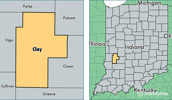
Clay County is a county equivalent area found in Indiana, USA. The county government of Clay is found in the county seat of Brazil.
With a total 933.23 sq. km of land and water area, Clay County, Indiana is the 2716th largest county equivalent area in the United States. Home to 26,562 people, Clay County has a total 11652 households earning 46430 on average per year.
Clay County, Indiana - Quick Facts
| FIPS Code | 18021 |
| Area Codes | 812 |
| Time Zone | EST |
| Major Cities | Brazil (population: 19,176), Clay City (population: 2,133), Centerpoint (population: 1,496), Cory (population: 636), Knightsville (population: 569), Staunton (population: 464), Harmony (population: 133) |
| Land Area | 10,256 sq miles |
| Water Area | 358 sq miles |
| Household Income | $46,430 |
| Housing Units | 11,652 |
| Median Home Value | $91,300 |
| High School Grads | 87% of population |
| Holders of Bachelors Degrees | 14% of population |
| Retail Spending | $11,737 per capita |
| Food & Accomodation Sales | $18,422 per capita |
This page was last updated on June 30, 2016.