Where is Blackford County, Indiana?
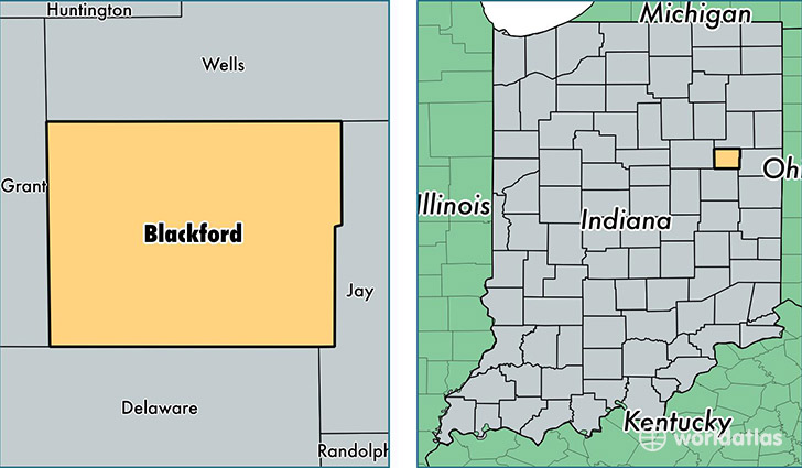
Blackford County is a county equivalent area found in Indiana, USA. The county government of Blackford is found in the county seat of Hartford City.
With a total 428.86 sq. km of land and water area, Blackford County, Indiana is the 3061st largest county equivalent area in the United States. Home to 12,401 people, Blackford County has a total 5984 households earning 39225 on average per year.
Blackford County, Indiana - Quick Facts
| FIPS Code | 18009 |
| Area Codes | 765 |
| Time Zone | EST |
| Major Cities | Hartford City (population: 9,624), Montpelier (population: 3,090) |
| Land Area | 4,788 sq miles |
| Water Area | 165 sq miles |
| Household Income | $39,225 |
| Housing Units | 5,984 |
| Median Home Value | $70,400 |
| High School Grads | 86% of population |
| Holders of Bachelors Degrees | 10% of population |
| Retail Spending | $7,389 per capita |
| Food & Accomodation Sales | $8,038 per capita |
This page was last updated on June 30, 2016.