Where is Union County, Illinois?
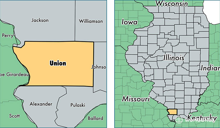
Union County is a county equivalent area found in Illinois, USA. The county government of Union is found in the county seat of Jonesboro.
With a total 1,093.36 sq. km of land and water area, Union County, Illinois is the 2482nd largest county equivalent area in the United States. Home to 17,447 people, Union County has a total 7870 households earning 41848 on average per year.
Union County, Illinois - Quick Facts
| FIPS Code | 17181 |
| Area Codes | 618 |
| Time Zone | CST |
| Major Cities | Anna (population: 7,210), Jonesboro (population: 3,339), Cobden (population: 3,235), Dongola (population: 2,238), McClure (population: 937), Alto Pass (population: 671), Wolf Lake (population: 415), Millcreek (population: 64) |
| Land Area | 6,736 sq miles |
| Water Area | 414 sq miles |
| Household Income | $41,848 |
| Housing Units | 7,870 |
| Median Home Value | $87,500 |
| High School Grads | 84% of population |
| Holders of Bachelors Degrees | 20% of population |
| Retail Spending | $8,009 per capita |
| Food & Accomodation Sales | $10,029 per capita |
This page was last updated on June 30, 2016.