Where is Hancock County, Illinois?
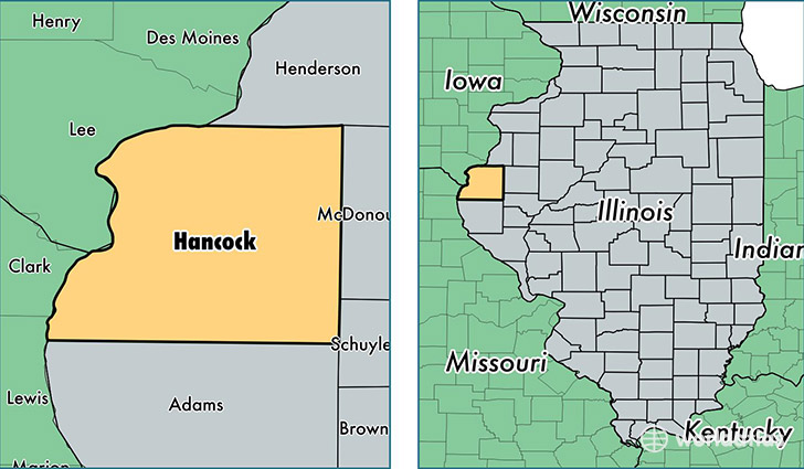
Hancock County is a county equivalent area found in Illinois, USA. The county government of Hancock is found in the county seat of Carthage.
With a total 2,109.28 sq. km of land and water area, Hancock County, Illinois is the 1145th largest county equivalent area in the United States. Home to 18,564 people, Hancock County has a total 9194 households earning 43925 on average per year.
Hancock County, Illinois - Quick Facts
| FIPS Code | 17067 |
| Area Codes | 217,309 |
| Time Zone | CST |
| Major Cities | Carthage (population: 4,045), Hamilton (population: 3,569), Warsaw (population: 2,026), Dallas City (population: 1,742), La Harpe (population: 1,721), Nauvoo (population: 1,665), Plymouth (population: 1,333), Augusta (population: 850), Niota (population: 743), Bowen (population: 652) |
| Land Area | 7,168 sq miles |
| Water Area | 794 sq miles |
| Household Income | $43,925 |
| Housing Units | 9,194 |
| Median Home Value | $81,600 |
| High School Grads | 91% of population |
| Holders of Bachelors Degrees | 18% of population |
| Retail Spending | $5,676 per capita |
| Food & Accomodation Sales | $10,926 per capita |
This page was last updated on June 30, 2016.