Where is Brown County, Illinois?
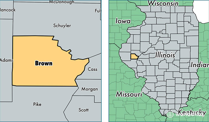
Brown County is a county equivalent area found in Illinois, USA. The county government of Brown is found in the county seat of Mount Sterling.
With a total 795.66 sq. km of land and water area, Brown County, Illinois is the 2835th largest county equivalent area in the United States. Home to 6,832 people, Brown County has a total 2431 households earning 42194 on average per year.
Brown County, Illinois - Quick Facts
| FIPS Code | 17009 |
| Area Codes | 217 |
| Time Zone | CST |
| Major Cities | Mount Sterling (population: 5,618), Versailles (population: 893), Timewell (population: 367) |
| Land Area | 2,638 sq miles |
| Water Area | 306 sq miles |
| Household Income | $42,194 |
| Housing Units | 2,431 |
| Median Home Value | $83,600 |
| High School Grads | 82% of population |
| Holders of Bachelors Degrees | 12% of population |
| Retail Spending | $4,597 per capita |
This page was last updated on June 30, 2016.