Where is Sioux County, Iowa?
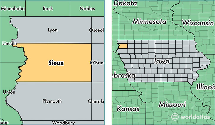
Sioux County is a county equivalent area found in Iowa, USA. The county government of Sioux is found in the county seat of Orange City.
With a total 1,991.68 sq. km of land and water area, Sioux County, Iowa is the 1238th largest county equivalent area in the United States. Home to 34,681 people, Sioux County has a total 12461 households earning 57227 on average per year.
Sioux County, Iowa - Quick Facts
| FIPS Code | 19167 |
| Area Codes | 712 |
| Time Zone | CST |
| Major Cities | Sioux Center (population: 8,387), Orange City (population: 7,092), Rock Valley (population: 4,951), Hawarden (population: 3,271), Hull (population: 3,175), Alton (population: 1,728), Boyden (population: 1,289), Ireton (population: 1,278), Hospers (population: 1,200), Granville (population: 793) |
| Land Area | 13,390 sq miles |
| Water Area | 768 sq miles |
| Household Income | $57,227 |
| Housing Units | 12,461 |
| Median Home Value | $131,200 |
| High School Grads | 89% of population |
| Holders of Bachelors Degrees | 23% of population |
| Retail Spending | $12,319 per capita |
| Food & Accomodation Sales | $31,746 per capita |
This page was last updated on June 30, 2016.