Where is Scott County, Iowa?
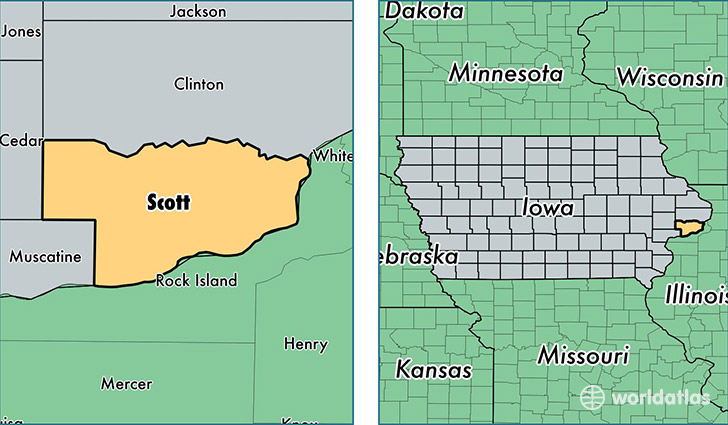
Scott County is a county equivalent area found in Iowa, USA. The county government of Scott is found in the county seat of Davenport.
With a total 1,212.66 sq. km of land and water area, Scott County, Iowa is the 2289th largest county equivalent area in the United States. Home to 171,387 people, Scott County has a total 72652 households earning 52735 on average per year.
Scott County, Iowa - Quick Facts
| FIPS Code | 19163 |
| Area Codes | 563 |
| Time Zone | CST |
| Major Cities | Davenport (population: 104,732), Bettendorf (population: 35,505), Eldridge (population: 9,041), Le Claire (population: 5,264), Blue Grass (population: 4,555), Walcott (population: 2,431), Long Grove (population: 2,179), Princeton (population: 1,456), Buffalo (population: 1,134), Donahue (population: 987) |
| Land Area | 66,173 sq miles |
| Water Area | 458 sq miles |
| Household Income | $52,735 |
| Housing Units | 72,652 |
| Median Home Value | $143,600 |
| High School Grads | 92% of population |
| Holders of Bachelors Degrees | 32% of population |
| Retail Spending | $17,574 per capita |
| Food & Accomodation Sales | $423,931 per capita |
This page was last updated on June 30, 2016.