Where is Marion County, Iowa?
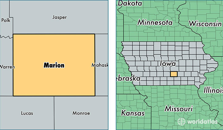
Marion County is a county equivalent area found in Iowa, USA. The county government of Marion is found in the county seat of Knoxville.
With a total 1,477.61 sq. km of land and water area, Marion County, Iowa is the 1928th largest county equivalent area in the United States. Home to 33,365 people, Marion County has a total 13915 households earning 54723 on average per year.
Marion County, Iowa - Quick Facts
| FIPS Code | 19125 |
| Area Codes | 641,515 |
| Time Zone | CST |
| Major Cities | Pella (population: 13,984), Knoxville (population: 11,758), Pleasantville (population: 2,951), Melcher Dallas (population: 1,603), Bussey (population: 889), Otley (population: 852), Tracy (population: 502), Harvey (population: 499), Hamilton (population: 299), Columbia (population: 238) |
| Land Area | 12,882 sq miles |
| Water Area | 554 sq miles |
| Household Income | $54,723 |
| Housing Units | 13,915 |
| Median Home Value | $132,000 |
| High School Grads | 92% of population |
| Holders of Bachelors Degrees | 25% of population |
| Retail Spending | $10,201 per capita |
| Food & Accomodation Sales | $28,951 per capita |
This page was last updated on June 30, 2016.