Where is Emmet County, Iowa?
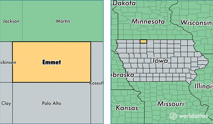
Emmet County is a county equivalent area found in Iowa, USA. The county government of Emmet is found in the county seat of Estherville.
With a total 1,042.52 sq. km of land and water area, Emmet County, Iowa is the 2593rd largest county equivalent area in the United States. Home to 9,990 people, Emmet County has a total 4741 households earning 48601 on average per year.
Emmet County, Iowa - Quick Facts
| FIPS Code | 19063 |
| Area Codes | 712 |
| Time Zone | CST |
| Major Cities | Estherville (population: 7,529), Armstrong (population: 1,427), Ringsted (population: 634), Wallingford (population: 444), Dolliver (population: 237) |
| Land Area | 3,857 sq miles |
| Water Area | 396 sq miles |
| Household Income | $48,601 |
| Housing Units | 4,741 |
| Median Home Value | $82,200 |
| High School Grads | 88% of population |
| Holders of Bachelors Degrees | 15% of population |
| Retail Spending | $8,961 per capita |
| Food & Accomodation Sales | $7,910 per capita |
| Universities and Colleges | Iowa Lakes Community College |
This page was last updated on June 30, 2016.