Where is Chickasaw County, Iowa?
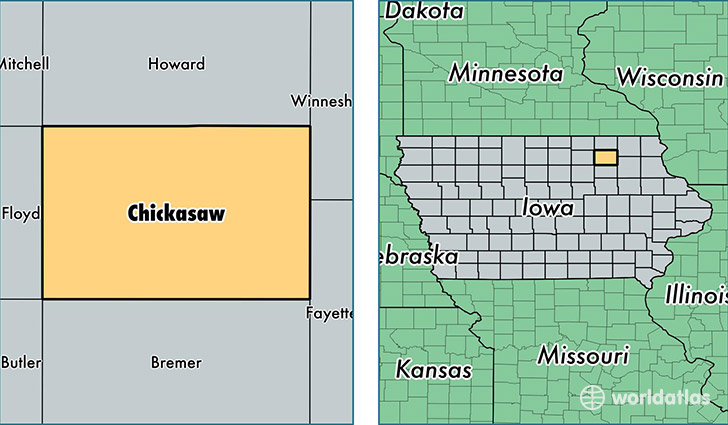
Chickasaw County is a county equivalent area found in Iowa, USA. The county government of Chickasaw is found in the county seat of New Hampton.
With a total 1,309.65 sq. km of land and water area, Chickasaw County, Iowa is the 2155th largest county equivalent area in the United States. Home to 12,264 people, Chickasaw County has a total 5652 households earning 43971 on average per year.
Chickasaw County, Iowa - Quick Facts
| FIPS Code | 19037 |
| Area Codes | 641,563 |
| Time Zone | CST |
| Major Cities | New Hampton (population: 5,416), Nashua (population: 2,484), Fredericksburg (population: 1,706), Ionia (population: 1,189), Lawler (population: 982), Alta Vista (population: 617) |
| Land Area | 4,735 sq miles |
| Water Area | 504 sq miles |
| Household Income | $43,971 |
| Housing Units | 5,652 |
| Median Home Value | $95,900 |
| High School Grads | 89% of population |
| Holders of Bachelors Degrees | 14% of population |
| Retail Spending | $8,537 per capita |
| Food & Accomodation Sales | $7,433 per capita |
This page was last updated on June 30, 2016.