Where is Franklin County, Florida?
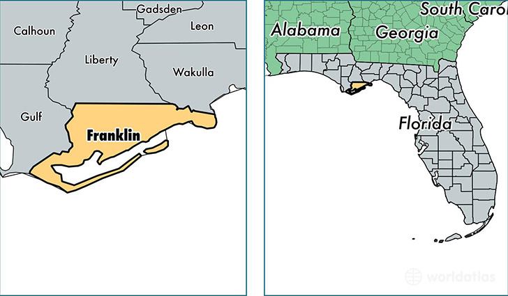
Franklin County is a county equivalent area found in Florida, USA. The county government of Franklin is found in the county seat of Apalachicola.
With a total 2,687.45 sq. km of land and water area, Franklin County, Florida is the 728th largest county equivalent area in the United States. Home to 11,815 people, Franklin County has a total 8547 households earning 38328 on average per year.
Franklin County, Florida - Quick Facts
| FIPS Code | 12037 |
| Area Codes | 850 |
| Time Zone | EST |
| Major Cities | Carrabelle (population: 4,054), Apalachicola (population: 3,903), Eastpoint (population: 3,186), Lanark Village (population: 219) |
| Land Area | 4,562 sq miles |
| Water Area | 545 sq miles |
| Household Income | $38,328 |
| Housing Units | 8,547 |
| Median Home Value | $143,900 |
| High School Grads | 79% of population |
| Holders of Bachelors Degrees | 14% of population |
| Retail Spending | $8,191 per capita |
| Food & Accomodation Sales | $37,568 per capita |
This page was last updated on June 30, 2016.