Where is Montezuma County, Colorado?
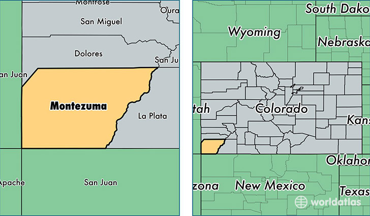
Montezuma County is a county equivalent area found in Colorado, USA. The county government of Montezuma is found in the county seat of Cortez.
With a total 5,283.91 sq. km of land and water area, Montezuma County, Colorado is the 312th largest county equivalent area in the United States. Home to 25,772 people, Montezuma County has a total 11928 households earning 43188 on average per year.
Montezuma County, Colorado offers the following attractions to visitors: Canyons of the Ancients NM, Mesa Verde NP, Yucca House NM
Montezuma County, Colorado - Quick Facts
| FIPS Code | 8083 |
| Area Codes | 970 |
| Time Zone | MST |
| Major Cities | Cortez (population: 14,400), Dolores (population: 4,389), Mancos (population: 4,055), Towaoc (population: 1,486), Lewis (population: 636), Pleasant View (population: 474), Yellow Jacket (population: 130), Mesa Verde National Park (population: 25) |
| Land Area | 9,951 sq miles |
| Water Area | 2,029 sq miles |
| Household Income | $43,188 |
| Housing Units | 11,928 |
| Median Home Value | $189,400 |
| High School Grads | 90% of population |
| Holders of Bachelors Degrees | 27% of population |
| Retail Spending | $12,003 per capita |
| Food & Accomodation Sales | $84,913 per capita |
This page was last updated on June 30, 2016.