Where is Mesa County, Colorado?
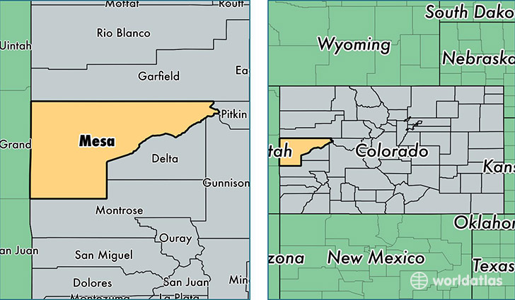
Mesa County is a county equivalent area found in Colorado, USA. The county government of Mesa is found in the county seat of Grand Junction.
With a total 8,653.42 sq. km of land and water area, Mesa County, Colorado is the 162nd largest county equivalent area in the United States. Home to 148,255 people, Mesa County has a total 63206 households earning 49471 on average per year.
Mesa County, Colorado offers the following attraction to visitors: Colorado NM
Mesa County, Colorado - Quick Facts
| FIPS Code | 8077 |
| Area Codes | 970 |
| Time Zone | MST |
| Major Cities | Grand Junction (population: 103,803), Fruita (population: 15,515), Clifton (population: 13,550), Palisade (population: 5,361), Loma (population: 2,317), Whitewater (population: 2,088), Collbran (population: 1,548), De Beque (population: 986), Mack (population: 877), Mesa (population: 799) |
| Land Area | 57,242 sq miles |
| Water Area | 3,329 sq miles |
| Household Income | $49,471 |
| Housing Units | 63,206 |
| Median Home Value | $210,100 |
| High School Grads | 90% of population |
| Holders of Bachelors Degrees | 26% of population |
| Retail Spending | $17,279 per capita |
| Food & Accomodation Sales | $268,843 per capita |
This page was last updated on June 30, 2016.