Where is Douglas County, Colorado?
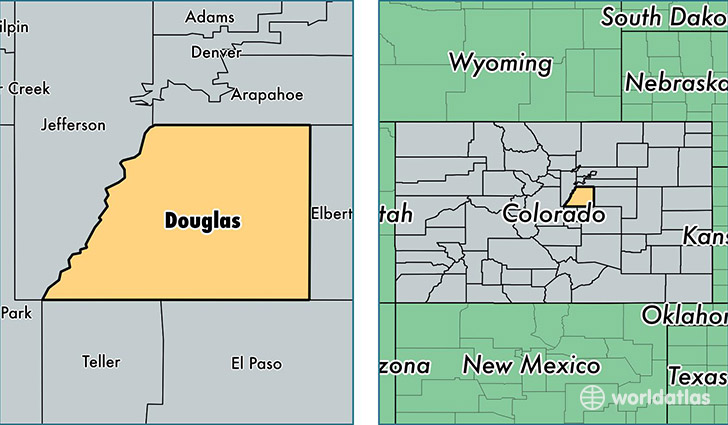
Douglas County is a county equivalent area found in Colorado, USA. The county government of Douglas is found in the county seat of Castle Rock.
With a total 2,182.97 sq. km of land and water area, Douglas County, Colorado is the 1095th largest county equivalent area in the United States. Home to 314,638 people, Douglas County has a total 111340 households earning 101591 on average per year.
Douglas County, Colorado - Quick Facts
| FIPS Code | 8035 |
| Area Codes | 303 |
| Time Zone | MST |
| Major Cities | Littleton (population: 108,591), Parker (population: 88,512), Castle Rock (population: 70,429), Lone Tree (population: 18,824), Larkspur (population: 5,545), Franktown (population: 4,118), Sedalia (population: 4,002), Louviers (population: 253) |
| Land Area | 121,482 sq miles |
| Water Area | 840 sq miles |
| Household Income | $101,591 |
| Housing Units | 111,340 |
| Median Home Value | $335,600 |
| High School Grads | 98% of population |
| Holders of Bachelors Degrees | 56% of population |
| Retail Spending | $13,846 per capita |
| Food & Accomodation Sales | $435,099 per capita |
This page was last updated on June 30, 2016.