Where is Broomfield County, Colorado?
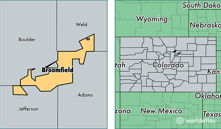
Broomfield County is a county equivalent area found in Colorado, USA. The county government of Broomfield is found in the county seat of Broomfield.
With a total 086.89 sq. km of land and water area, Broomfield County, Colorado is the 3117th largest county equivalent area in the United States. Home to 62,138 people, Broomfield County has a total 25007 households earning 77998 on average per year.
Broomfield County, Colorado - Quick Facts
| FIPS Code | 8014 |
| Area Codes | 303 |
| Time Zone | MST |
| Major Cities | Broomfield (population: 64,777) |
| Land Area | 23,992 sq miles |
| Water Area | 33 sq miles |
| Household Income | $77,998 |
| Housing Units | 25,007 |
| Median Home Value | $275,900 |
| High School Grads | 95% of population |
| Holders of Bachelors Degrees | 48% of population |
| Retail Spending | $21,240 per capita |
| Food & Accomodation Sales | $163,445 per capita |
This page was last updated on June 30, 2016.