Where is Boulder County, Colorado?
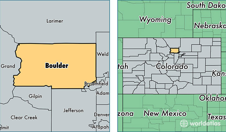
Boulder County is a county equivalent area found in Colorado, USA. The county government of Boulder is found in the county seat of Boulder.
With a total 1,917.8 sq. km of land and water area, Boulder County, Colorado is the 1302nd largest county equivalent area in the United States. Home to 313,333 people, Boulder County has a total 129247 households earning 67956 on average per year.
Boulder County, Colorado - Quick Facts
| FIPS Code | 8013 |
| Area Codes | 303 |
| Time Zone | MST |
| Major Cities | Boulder (population: 125,344), Longmont (population: 121,868), Louisville (population: 32,166), Lafayette (population: 27,340), Nederland (population: 3,459), Ward (population: 592), Jamestown (population: 515), Allenspark (population: 435), Eldorado Springs (population: 262), Niwot (population: 115) |
| Land Area | 120,978 sq miles |
| Water Area | 726 sq miles |
| Household Income | $67,956 |
| Housing Units | 129,247 |
| Median Home Value | $350,900 |
| High School Grads | 94% of population |
| Holders of Bachelors Degrees | 58% of population |
| Retail Spending | $13,660 per capita |
| Food & Accomodation Sales | $668,939 per capita |
This page was last updated on June 30, 2016.