Where is Santa Barbara County, California?
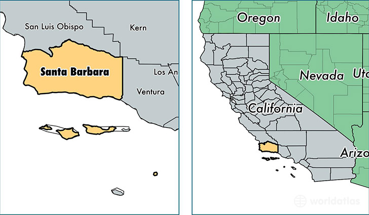
Santa Barbara County is a county equivalent area found in California, USA. The county government of Santa Barbara is found in the county seat of Santa Barbara.
With a total 9,813.74 sq. km of land and water area, Santa Barbara County, California is the 140th largest county equivalent area in the United States. Home to 440,668 people, Santa Barbara County has a total 153521 households earning 62779 on average per year.
Santa Barbara County, California offers the following attraction to visitors: Channel Islands NP
Santa Barbara County, California - Quick Facts
| FIPS Code | 6083 |
| Area Codes | 805,661 |
| Time Zone | PST |
| Major Cities | Santa Maria (population: 135,879), Santa Barbara (population: 135,218), Lompoc (population: 58,349), Goleta (population: 54,140), Carpinteria (population: 16,369), Solvang (population: 7,778), Guadalupe (population: 7,233), Buellton (population: 5,600), Santa Ynez (population: 5,346), Los Alamos (population: 2,093) |
| Land Area | 170,143 sq miles |
| Water Area | 2,735 sq miles |
| Household Income | $62,779 |
| Housing Units | 153,521 |
| Median Home Value | $453,000 |
| High School Grads | 79% of population |
| Holders of Bachelors Degrees | 31% of population |
| Retail Spending | $12,443 per capita |
| Food & Accomodation Sales | $1,361,476 per capita |
| Universities and Colleges | Antioch University-Santa Barbara, University of California-Santa Barbara, Fielding Graduate University |
This page was last updated on June 30, 2016.