Where is Nevada County, California?
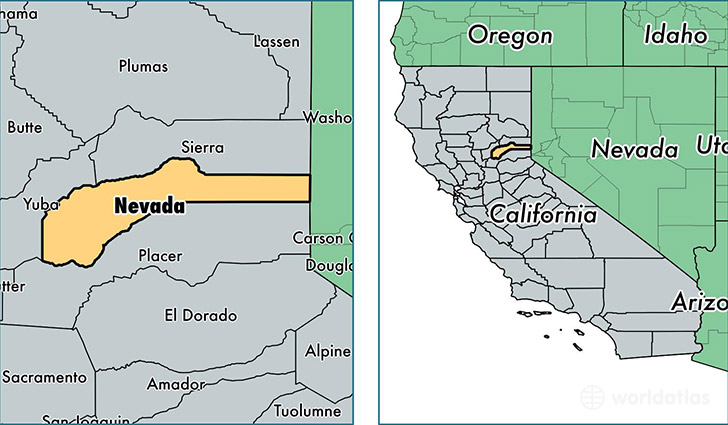
Nevada County is a county equivalent area found in California, USA. The county government of Nevada is found in the county seat of Nevada City.
With a total 2,522.15 sq. km of land and water area, Nevada County, California is the 807th largest county equivalent area in the United States. Home to 98,893 people, Nevada County has a total 52787 households earning 57353 on average per year.
Nevada County, California - Quick Facts
| FIPS Code | 6057 |
| Area Codes | 530 |
| Time Zone | PST |
| Major Cities | Grass Valley (population: 44,724), Truckee (population: 18,437), Nevada City (population: 17,752), Penn Valley (population: 9,743), Rough and Ready (population: 1,760), Smartsville (population: 1,679), North San Juan (population: 786), Soda Springs (population: 396), Washington (population: 161), Floriston (population: 155) |
| Land Area | 38,183 sq miles |
| Water Area | 958 sq miles |
| Household Income | $57,353 |
| Housing Units | 52,787 |
| Median Home Value | $357,300 |
| High School Grads | 94% of population |
| Holders of Bachelors Degrees | 32% of population |
| Retail Spending | $11,111 per capita |
| Food & Accomodation Sales | $199,443 per capita |
This page was last updated on June 30, 2016.