Where is Madera County, California?
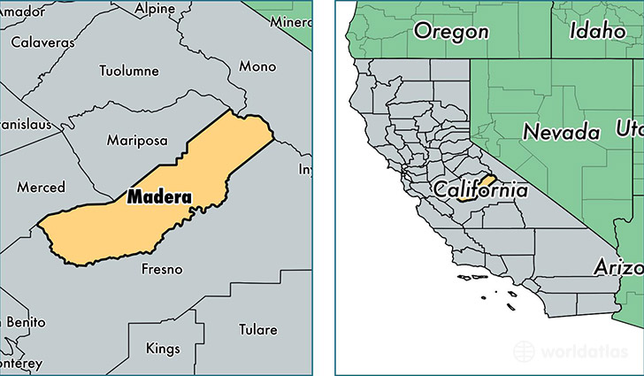
Madera County is a county equivalent area found in California, USA. The county government of Madera is found in the county seat of Madera.
With a total 5,577.02 sq. km of land and water area, Madera County, California is the 291st largest county equivalent area in the United States. Home to 154,548 people, Madera County has a total 49565 households earning 45625 on average per year.
Madera County, California offers the following attraction to visitors: Devils Postpile NM
Madera County, California - Quick Facts
| FIPS Code | 6039 |
| Area Codes | 559 |
| Time Zone | PST |
| Major Cities | Madera (population: 99,603), Chowchilla (population: 24,049), Coarsegold (population: 11,765), Oakhurst (population: 8,714), North Fork (population: 3,199), Ahwahnee (population: 1,923), Raymond (population: 1,237), Bass Lake (population: 680), O Neals (population: 320), Wishon (population: 297) |
| Land Area | 59,671 sq miles |
| Water Area | 2,137 sq miles |
| Household Income | $45,625 |
| Housing Units | 49,565 |
| Median Home Value | $182,000 |
| High School Grads | 69% of population |
| Holders of Bachelors Degrees | 14% of population |
| Retail Spending | $6,956 per capita |
| Food & Accomodation Sales | $125,079 per capita |
This page was last updated on June 30, 2016.