Where is Montgomery County, Alabama?
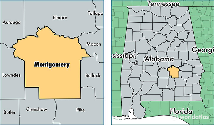
Montgomery County is a county equivalent area found in Alabama, USA. The county government of Montgomery is found in the county seat of Montgomery.
With a total 2,071.76 sq. km of land and water area, Montgomery County, Alabama is the 1178th largest county equivalent area in the United States. Home to 226,189 people, Montgomery County has a total 102889 households earning 44790 on average per year.
Montgomery County, Alabama offers the following attraction to visitors: Selma to Montgomery NHT
Montgomery County, Alabama - Quick Facts
| FIPS Code | 1101 |
| Area Codes | 334 |
| Time Zone | CST |
| Major Cities | Montgomery (population: 215,433), Pike Road (population: 6,776), Hope Hull (population: 3,626), Grady (population: 2,015), Ramer (population: 1,942), Mathews (population: 740), Cecil (population: 563), Pine Level (population: 47) |
| Land Area | 87,332 sq miles |
| Water Area | 784 sq miles |
| Household Income | $44,790 |
| Housing Units | 102,889 |
| Median Home Value | $122,900 |
| High School Grads | 86% of population |
| Holders of Bachelors Degrees | 32% of population |
| Retail Spending | $14,351 per capita |
| Food & Accomodation Sales | $402,861 per capita |
| Universities and Colleges | Auburn University-Montgomery |
This page was last updated on June 30, 2016.