Where is Lowndes County, Alabama?
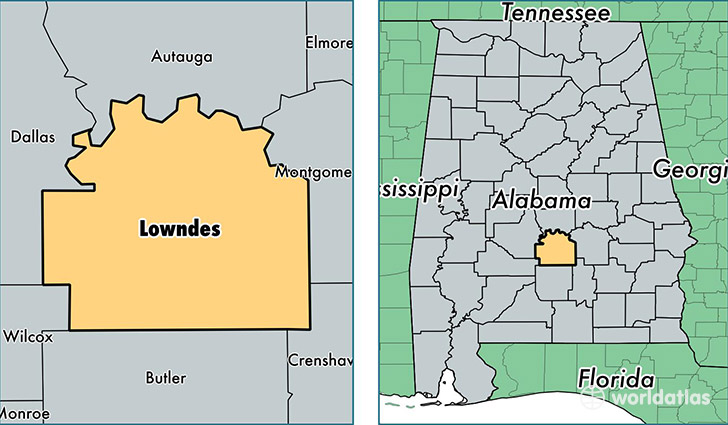
Lowndes County is a county equivalent area found in Alabama, USA. The county government of Lowndes is found in the county seat of Hayneville.
With a total 1,877.92 sq. km of land and water area, Lowndes County, Alabama is the 1340th largest county equivalent area in the United States. Home to 10,580 people, Lowndes County has a total 5053 households earning 26230 on average per year.
Lowndes County, Alabama - Quick Facts
| FIPS Code | 1085 |
| Area Codes | 334 |
| Time Zone | CST |
| Major Cities | Hayneville (population: 3,820), Fort Deposit (population: 2,250), Lowndesboro (population: 1,579), Letohatchee (population: 1,356), Tyler (population: 1,124) |
| Land Area | 4,085 sq miles |
| Water Area | 716 sq miles |
| Household Income | $26,230 |
| Housing Units | 5,053 |
| Median Home Value | $71,400 |
| High School Grads | 74% of population |
| Holders of Bachelors Degrees | 14% of population |
| Retail Spending | $8,184 per capita |
| Food & Accomodation Sales | $595 per capita |
This page was last updated on June 30, 2016.