Where is Houston County, Alabama?
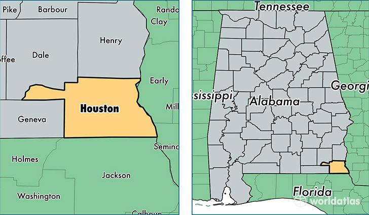
Houston County is a county equivalent area found in Alabama, USA. The county government of Houston is found in the county seat of Dothan.
With a total 1,506.48 sq. km of land and water area, Houston County, Alabama is the 1823rd largest county equivalent area in the United States. Home to 104,193 people, Houston County has a total 45958 households earning 40948 on average per year.
Houston County, Alabama - Quick Facts
| FIPS Code | 1069 |
| Area Codes | 334 |
| Time Zone | CST |
| Major Cities | Dothan (population: 81,887), Ashford (population: 6,300), Newton (population: 4,946), Cottonwood (population: 3,907), Webb (population: 2,489), Columbia (population: 2,300), Cowarts (population: 1,661), Gordon (population: 1,607), Pansey (population: 989) |
| Land Area | 40,229 sq miles |
| Water Area | 580 sq miles |
| Household Income | $40,948 |
| Housing Units | 45,958 |
| Median Home Value | $122,300 |
| High School Grads | 84% of population |
| Holders of Bachelors Degrees | 20% of population |
| Retail Spending | $19,608 per capita |
| Food & Accomodation Sales | $177,224 per capita |
This page was last updated on June 30, 2016.