Where is Etowah County, Alabama?
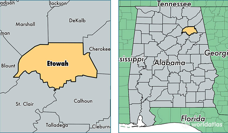
Etowah County is a county equivalent area found in Alabama, USA. The county government of Etowah is found in the county seat of Gadsden.
With a total 1,420.94 sq. km of land and water area, Etowah County, Alabama is the 2008th largest county equivalent area in the United States. Home to 103,531 people, Etowah County has a total 47306 households earning 38013 on average per year.
Etowah County, Alabama - Quick Facts
| FIPS Code | 1055 |
| Area Codes | 256,205 |
| Time Zone | CST |
| Major Cities | Gadsden (population: 67,047), Attalla (population: 12,411), Rainbow City (population: 9,893), Boaz (population: 8,838), Altoona (population: 7,752), Gallant (population: 1,143), Walnut Grove (population: 37) |
| Land Area | 39,974 sq miles |
| Water Area | 536 sq miles |
| Household Income | $38,013 |
| Housing Units | 47,306 |
| Median Home Value | $100,000 |
| High School Grads | 82% of population |
| Holders of Bachelors Degrees | 15% of population |
| Retail Spending | $10,801 per capita |
| Food & Accomodation Sales | $137,966 per capita |
This page was last updated on June 30, 2016.