Where is Chambers County, Alabama?
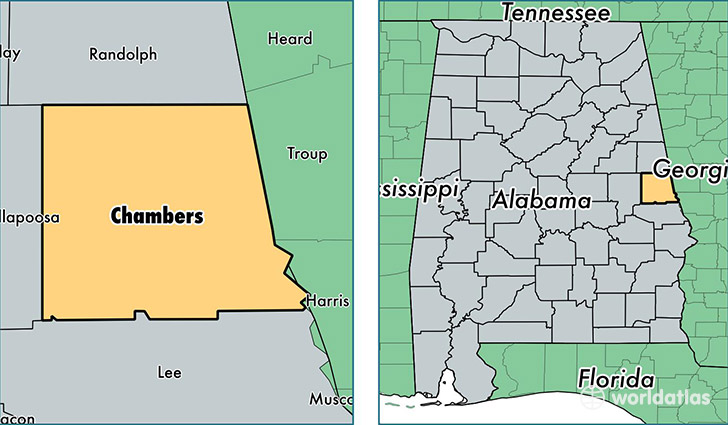
Chambers County is a county equivalent area found in Alabama, USA. The county government of Chambers is found in the county seat of Lafayette.
With a total 1,562.06 sq. km of land and water area, Chambers County, Alabama is the 1730th largest county equivalent area in the United States. Home to 34,076 people, Chambers County has a total 16829 households earning 32402 on average per year.
Chambers County, Alabama - Quick Facts
| FIPS Code | 1017 |
| Area Codes | 334 |
| Time Zone | CST |
| Major Cities | Valley (population: 14,650), Lanett (population: 11,620), Lafayette (population: 6,593), Five Points (population: 1,544) |
| Land Area | 13,157 sq miles |
| Water Area | 597 sq miles |
| Household Income | $32,402 |
| Housing Units | 16,829 |
| Median Home Value | $81,200 |
| High School Grads | 75% of population |
| Holders of Bachelors Degrees | 12% of population |
| Retail Spending | $7,620 per capita |
| Food & Accomodation Sales | $23,237 per capita |
This page was last updated on June 30, 2016.