State of Brandenburg, Germany
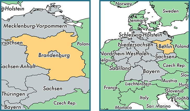
Brandenburg is a state found in the nation of Germany. Home to 2,455,780 people, it is the 10th largest division in Germany in terms of population.
Brandenburg gained its current status as a state in the year 1990. The government of Brandenburg is lead by Dietmar Woidke and is based in the state capital of Potsdam (Population: 145,292).
The most populous cities in Brandenburg are: Potsdam (Population: 145,292), Cottbus (Population: 84,754), Brandenburg an der Havel (Population: 59,826), Frankfurt (Oder) (Population: 51,691).
Brandenburg State - Quick Facts
| Country | Germany |
| Region Type | State |
| ISO Code | DE_BB |
| Time Zone | CEST |
| Year of Establishment | 1990 |
| Capital | Potsdam (Population: 145,292) |
| Head of Government | Dietmar Woidke |
| Total Population | 2,455,780 |
| Total Area | 29,477 sq km (11,381 sq miles) |
| Population Density | 83.3 sq km (215.8 sq miles) |
This page was last updated on July 24, 2015.