Where is Tanjung Pandan, Indonesia?
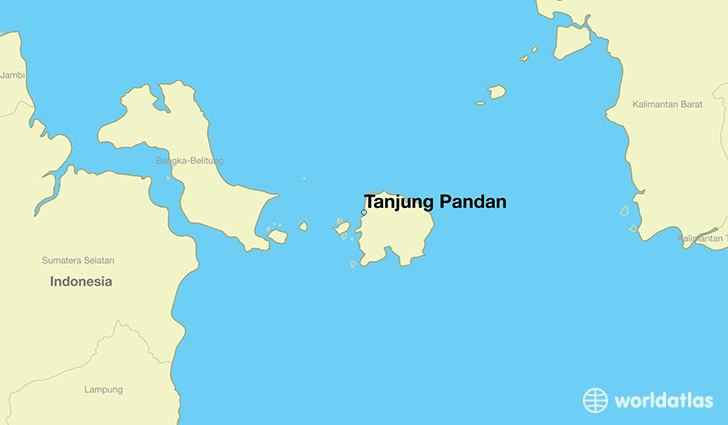
Tanjung Pandan is a city found in Bangka-Belitung Islands, Indonesia. It is located -2.73 latitude and 107.63 longitude and it is situated at elevation 8 meters above sea level.
Tanjung Pandan has a population of 62,374 making it the 3rd biggest city in Bangka-Belitung Islands. It operates on the BMT time zone, which means that it follows the same time zone as Pangkalpinang.
Quick facts
| Country | Indonesia |
| State | Bangka-Belitung Islands |
| Population | 62,374 |
| Elevation | 8 m over sea level |
| Time Zone | BMT |
| Longitude | 107.634770 |
| Latitude | -2.733530 |
This page was last updated on October 2, 2015.