Transcontinental Countries Of The World
- Transcontinental countries are countries with territory in two or more continents.
- There are contiguous transcontinental countries, non-contiguous transcontinental countries, and countries that may or may not be transcontinental based on one's interpretation of what the continents are.
- Russia, Kazakhstan, Turkey, and Egypt are contiguous transcontinental countries.
- Most non-contiguous transcontinental countries are countries with overseas territories.
A transcontinental country is a country with territory on two or more continents. There are some countries that are contiguous transcontinental countries, which means that there is no gap of any sort between the country’s territory in one continent and its territory in another. There are very few contiguous transcontinental countries.
There are, however, many non-continuous continental countries. These are mainly countries with overseas possessions. Thus, the main territory of a country could be on one continent, but it may also have territory much farther away in another continent. The third type of transcontinental countries is those that are transcontinental depending on interpretation. Continents are grouped differently depending on where in the world you live.
Contents:
- Contiguous Transcontinental Countries
- Non-Contiguous Transcontinental Countries
- Possibly Transcontinental Countries
Contiguous Transcontinental Countries
Russia

Russia is the largest contiguous transcontinental country in the world. It has territory in both Europe and Asia. Its European territory is the area of the country west of the Ural Mountains, which is considered the continental border between Europe and Asia. Russia’s Asian territory, which is collectively known as Siberia, consists of the entire area east of the Urals. This area is bordered to the north by the Barents Sea, Kara Sea, and East Siberian Sea from west to east. Bordering the south of Siberia are the countries of Kazakhstan, Mongolia, and China from west to east. North Korea also shares a border with Russia, in the far southeast of Siberia. Siberia stretches from the Ural Mountains in the west, all the way to the Bering Sea in the east, across which is the US State of Alaska. Other bodies of water that border Siberia are the Sea of Okhotsk and the Sea of Japan.
Kazakhstan

Kazakhstan is located to the south of Russia. It is also bordered to the west by Russia, to the southwest by the Caspian Sea, and to the south by Turkmenistan, Uzbekistan, and Kyrgyzstan. China borders Kazakhstan to the southeast. As is the case with Russia, Kazakhstan has contiguous territory in both Europe and Asia. The Ural River, which flows into northwestern Kazakhstan, is considered to be part of the border between Europe and Asia. Thus, it puts most of Kazakhstan’s territory in Asia.
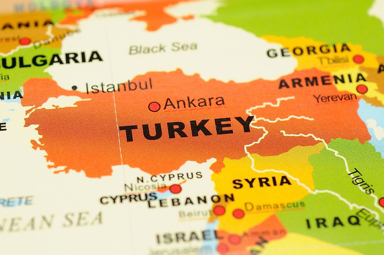
Turkey

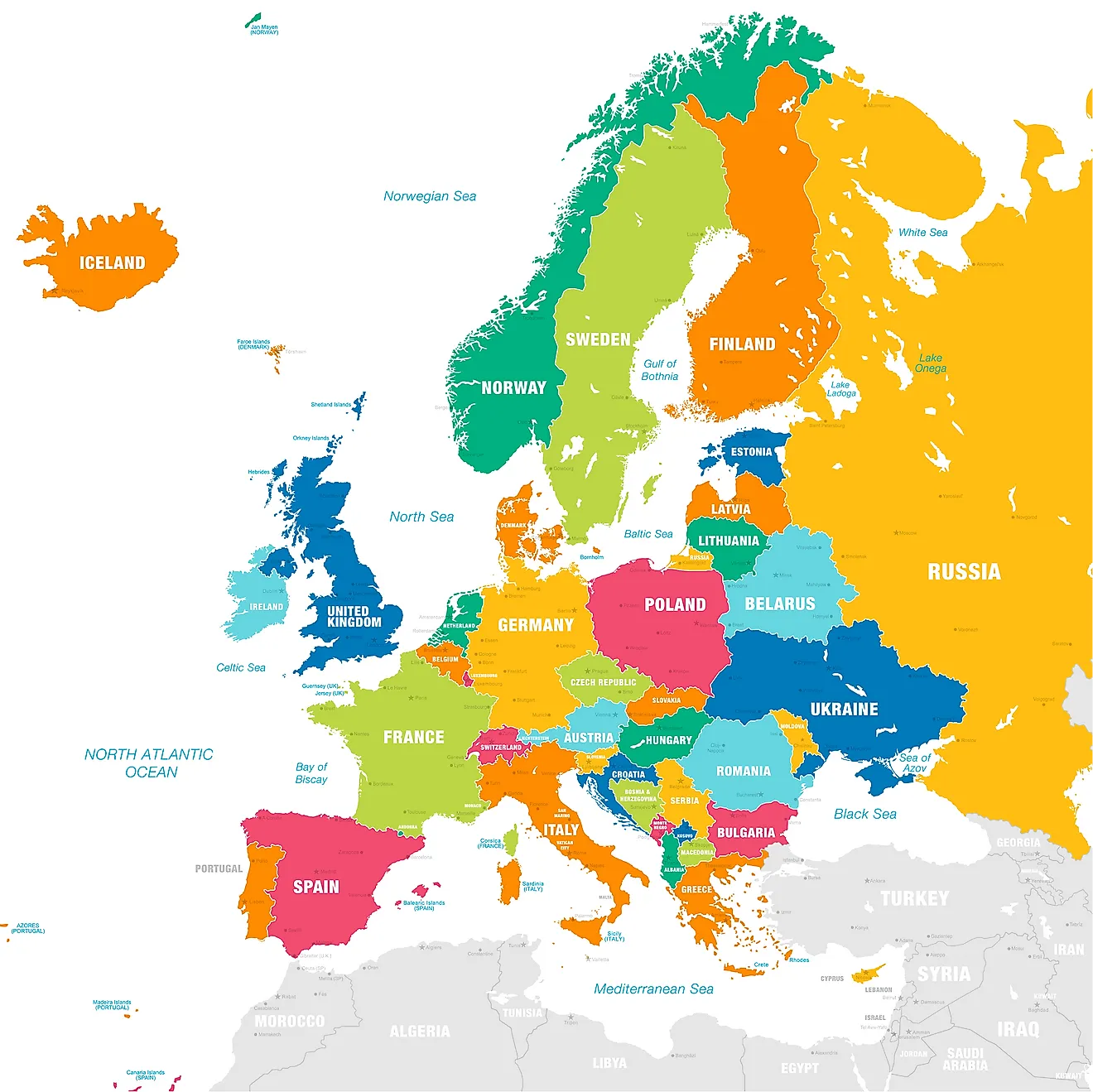
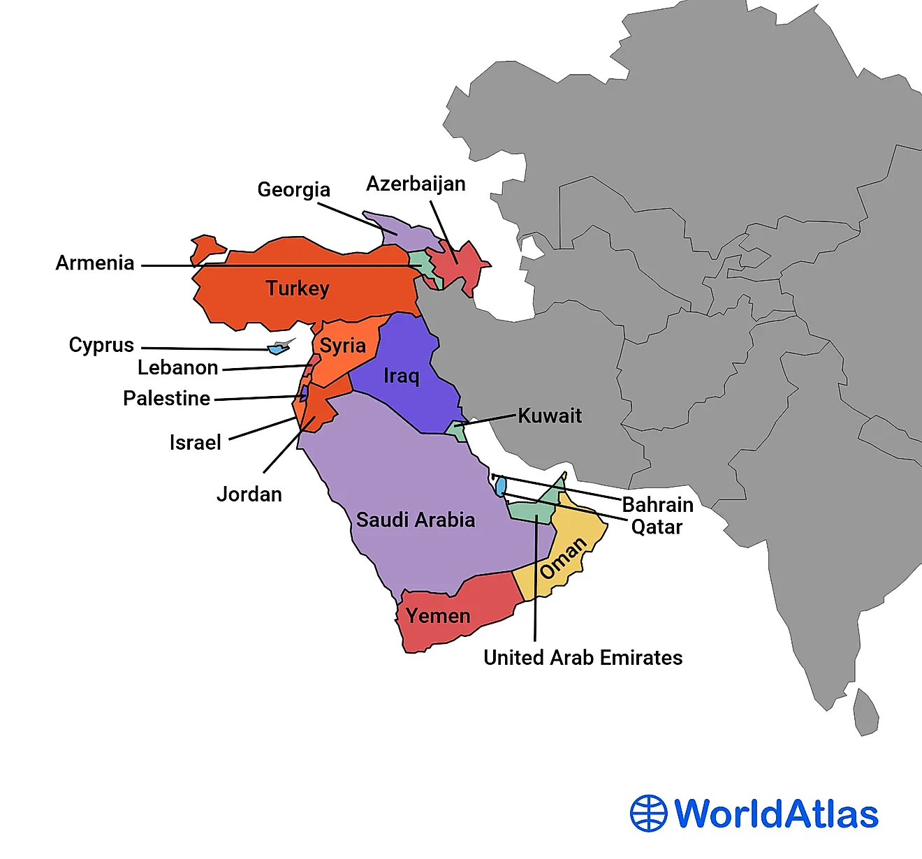
Turkey, which is located between the Black Sea to the north and the Mediterranean Sea to the south, consists of two parts. The larger part is what is known as Anatolia or Asia Minor. It is bordered to its east and northeast by the Caucasus countries of Armenia and Georgia, to the southeast by Iran, and to the immediate south by Syria and Iraq. Off Anatolia’s west coast is the Aegean Sea. The smaller part of Turkey forms part of a region known as Thrace, which is shared by Turkey in the east and Greece in the west. This part of Turkey is also bordered to the north by Bulgaria, to the northeast and east by the Black Sea and the Bosporus Strait, and to the south by the Sea of Marmara and the Dardanelles Strait.
Collectively, it is the Dardanelles Straits, the Sea of Marmara, the Bosporus Straits, and the Aegean Sea that form the continental border between Europe and Asia. On the west and east sides of the Bosporus Strait are the European and Asian parts of the city of Istanbul, respectively. Istanbul is the biggest city in Turkey, and although part of it is situated in Turkey’s Asian territory, it is considered the most populous city in Europe. The vast majority of the Turks, however, live in the Asian part of the country.
Egypt
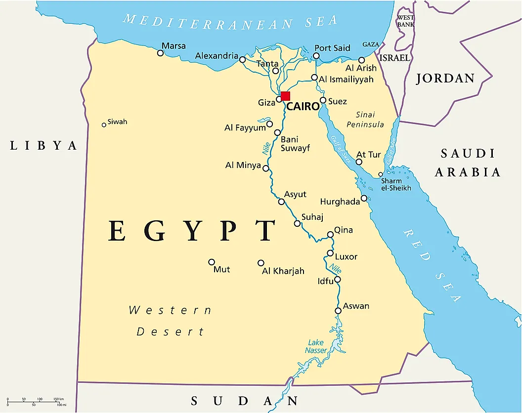
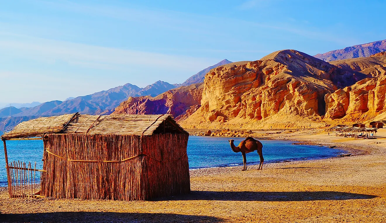
Egypt is a country whose territory is located mostly in North Africa. A small part of Egyptian territory, however, is considered part of Asia. This small part is known as the Sinai Peninsula, which serves as a land bridge between Africa and Asia. The point at which Africa and Asia meet in the Sinai is the Isthmus of Suez, where the Suez Canal is now located. Thus, the Egyptian territory west of the Suez Canal is part of Africa, while the Egyptian territory in the Sinai is part of Asia, making Egypt a contiguous transcontinental country.
Non-Contiguous Transcontinental Countries
United States Of America

The mainland territories of the United States are the continental United States and Alaska. Both of these territories are in North America. However, the US has several overseas possessions that are not part of North America. The US State of Hawaii, for example, is part of Oceania, which is considered a continent in some parts of the world. Many US territories are also part of Oceania. These include Guam, the Northern Mariana Islands, American Samoa, and several other tiny atolls and islands.
The United Kingdom

The United Kingdom has overseas territories that are not part of Europe. These include several islands in the Caribbean, which is part of North America. Bermuda, the Pitcairn Islands, Saint Helena, Ascension, Tristan da Cunha, South Georgia, and the South Sandwich Islands are also British overseas territories not located in Europe.
France

France has many overseas territories that are not located in Europe. Most of these are small island territories, such as French Polynesia and New Caledonia in Oceania, Reunion in Africa, and Martinique in the Caribbean. French Guiana is also an overseas territory of France and is located in the northern mainland of South America.
Spain

Spain has two territories on the North African mainland, known as Ceuta and Melilla. The Canary Islands, which is also part of Spain, are also considered to be part of Africa from a geographical perspective.
Portugal

Portugal controls an archipelago of islands known as the Azores, which lie to the northwest of North Africa. Two of the archipelago’s westernmost islands, the Flores and Corvo Islands, are situated on the North American tectonic plate.
The Netherlands

The Netherlands controls several islands in the Caribbean, including Aruba and Curaçao.
Denmark

Denmark controls the world’s largest island, Greenland, which is geographically part of North America.
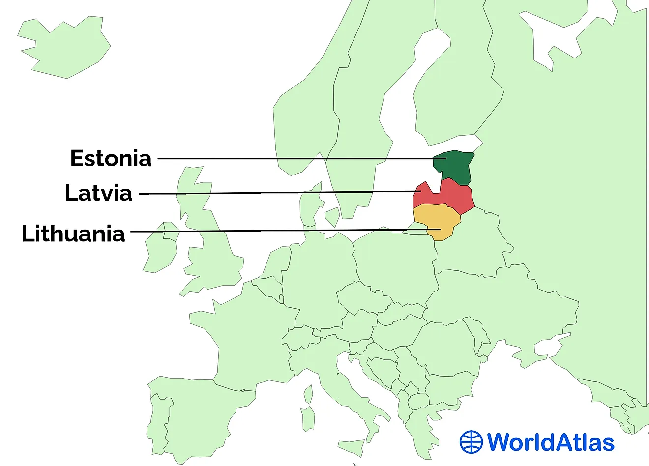
Greece

Greece controls many islands in the Aegean Sea, which is considered to be part of the border between Europe and Asia. Thus, some of the small Greek islands in the Aegean Sea may technically be part of Asia, while the bulk of Greek territory is in Southern Europe.
Italy

South of the Italian-controlled island of Sicily, located in the Mediterranean Sea, are the Pelagie Islands. Two of these islands, Lampedusa and Lampione, are geographically part of Africa, whereas most of Italy consists of territory in Southern Europe.
Chile

Chile is located on the southern end of South America, on the west coast, facing the Pacific Ocean. Chile also, however, controls an island in the South Pacific known as Rapa Nui, which is located in Oceania.
Venezuela

Venezuela is located in northern South America, on the southern coast of the Caribbean. The country controls some Caribbean islands like the Los Roques Archipelago, and since the Caribbean is considered part of North America, these islands are part of a different continent than the rest of Venezuela.
Yemen

Yemen is located on the Arabian Peninsula in Western Asia. The country does, however, control a small archipelago of islands known as the Socotra Archipelago. This archipelago, located south of the Yemeni mainland in the Arabian Sea, is geographically considered part of Africa.
Possibly Transcontinental Countries
Georgia

The Caucasus Mountains are often cited as the border between Europe and Asia in that part of the world. In theory, this would mean that Georgia, being south of these mountains, is part of Asia. However, a small part of northwestern Georgia lies to the north of the Caucasus Mountains, which would mean that the country does have a small foothold in Europe as well, even if some like to simplify things by just putting all of Georgia in Asia.
Azerbaijan

Like Georgia, Azerbaijan is also located in the South Caucasus region. While most of the country is located in Asia, a small portion in the north is claimed to be in Europe as the Caucasus Mountains are regarded as a division between Asia and Europe.
Indonesia

Indonesia is a vast archipelago of about 17,508 islands in Southeast Asia. Part of its territory includes about half of the island of New Guinea. New Guinea is considered by some to be part of Oceania, which, as previously mentioned, is considered a continent in some parts of the world. Thus, by this interpretation, Indonesia could be considered a transcontinental country with territory in both Asia and Oceania.
Australia

Many people around the world consider Australia to be a continent in and of itself. Others, however, see it as part of Oceania. Thus, depending on one’s interpretation, the country can be both a continent by itself and a large part of Oceania.
Colombia And Panama

The border between Panama and Colombia is widely considered to be the geographic demarcation line between North and South America, thus putting Panama in North America and Colombia in South America. There is, however, some disagreement over the exact geographical border between the two continents. It is generally accepted that the border lies somewhere in the Isthmus of Panama. The country of Panama controls most of the isthmus, but a small, southern part of it is controlled by Colombia. Thus, either Panama or Colombia could be a transcontinental country depending on where the exact border in the Isthmus of Panama is.