What Is the Capital of Kiribati?
Located in the central Pacific Ocean, the island nation of Kiribati is an archipelago encompassing a total area of 3.5 million square km. The nation’s atolls, reefs and coral islands cover a total land area of 800 square km. The population of the country was 110,136 in 2015. Kiribati is one of the world’s least developed nations. A lack of natural resources is the biggest factor hindering the nation's economic growth. Fishing and copra production are the only major industries in Kiribati.
What Is the Capital of Kiribati and Where Is it Located?
The atoll of Tarawa is the seat of the national government of Kiribati. The atoll has two distinct areas, the North and the South Tarawa. The former is a remote area with little human habitation, while the latter is home to nearly 50% of the population of Kiribati. The population of Tarawa was 56,284 in 2010. The lagoon enclosed by the atoll covers an area of 500 square km. Although North Tarawa is still divided into small islets separated by wide and deep stretches of the ocean in some areas, South Tarawa’s islets have been artificially joined by causeways to create a well-connected stretch of islets.
History of the Capital of Kiribati
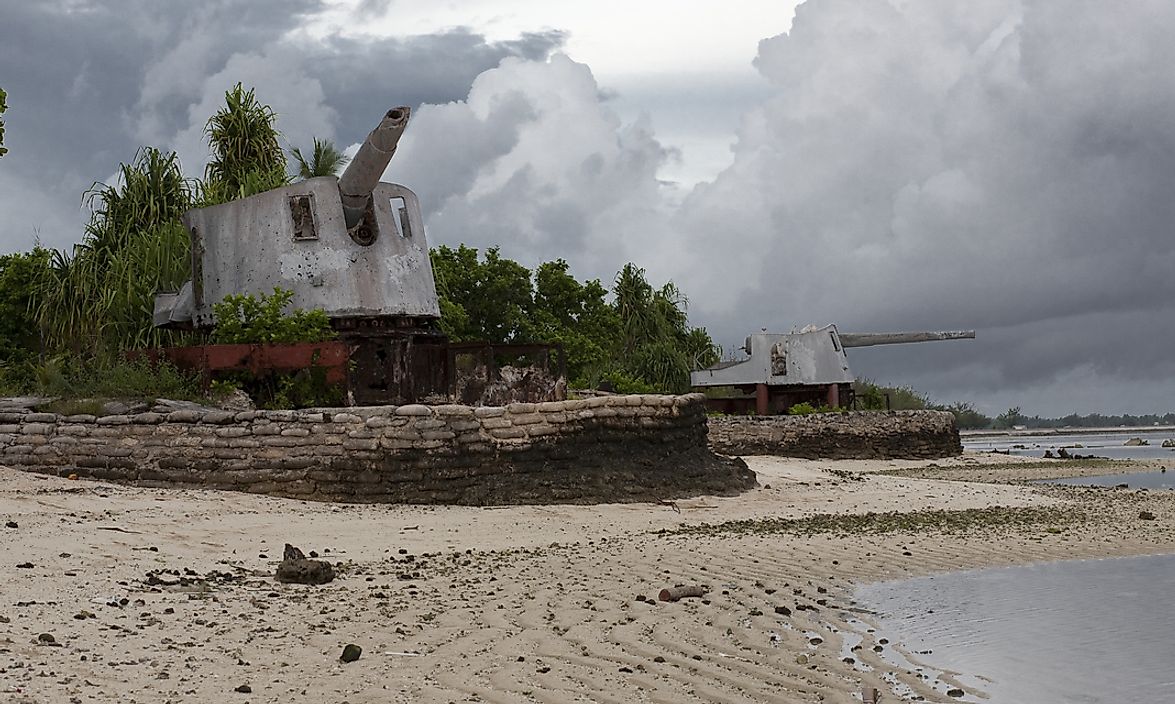
Humans have lived on the islands of Kiribati, including Tarawa, since antiquity. The country has experienced several periods of immigration and emigration to and from the area. The indigenous inhabitants of Kiribati are strong seafarers and well-adapted to live in the unique habitat of the island nation. On June 20, 1788, British explorer Thomas Gilbert was the first European to arrive in Tarawa. Gilbert was the first to record the existence of the atolls and islands of Kiribati. Soon, other European explorers began arriving at Kiribati and carried out extensive expeditions in the area. A British colony was soon established in Kiribati, and the British gradually developed infrastructure and modern settlements. During World War II, Tarawa was annexed by Japanese troops. A bloody battle, known as the Battle of Tarawa, occurred on November 20, 1943, between Japanese and American troops, which resulted in heavy losses on both sides. The battle was won by the US forces, but at the cost many soldier casualties. On July 12, 1979, the newly independent nation of the Republic of Kiribati emerged after gaining freedom from British rule. Tarawa was declared the capital city of Kiribati.
Current Role of the Capital of Kiribati
Most of the important government buildings, ministries, foreign embassies, and other related offices and departments of Kiribati are located in South Tarawa. The House of Assembly is located here, and serves as the meeting place of the central government's National Assembly. South Tarawa is also home to several educational institutions, hospitals, churches, and other important buildings. South Tarawa is Kiribati’s economic hub. Copra and fish processing and trading are the largest industries, and several banks and other financial institutions have their offices in Tarawa. The country’s main airport and port are both located in South Tarawa.
Over the years, the economy of Kiribati has weakened. Climate change is negatively impacting South Tarawa’s limited freshwater resources, as rising sea levels increase the salinity levels of soil. The area's low elevation increases susceptibility to climate change-induced natural disasters. Unemployment is a major issue, and many families depend on remittances received from relatives working abroad.