The Most Isolated, Uninhabited (Or Least Inhabited) Territories Of The US
Most individuals are familiar with the territory of the US, which consists of 50 states (48 of which are in the mainland, 1 island in the Pacific Ocean, and 1 state in the northwestern region of North America). This country also has a number of large territories and small islands, located throughout the Pacific Ocean and the Caribbean Sea. This article takes a closer look at the most isolated of these US territories.
9. Navassa Island
Navassa Island covers an area of between 2 and 3 square miles in the Caribbean Sea. Despite being managed by the US Fish and Wildlife Service, Haiti disputes US ownership of this island. The Constitution of Haiti, first established in 1801, claimed Navassa Island as Haitian territory. In 1857, however, a US ship captain discovered guano (bird excrement) on the island and claimed it for the US based on the Guano Islands Act of 1856. In 1858, a presidential order enforced the claim and issued a call for military action to defend the territory. The last known inhabitants of this island lived here between 1917 and 1929 as keepers of the US-built lighthouse.
8. Midway Atoll
The Midway Atoll, also known as the Midway Islands, covers an approximate area between 2 and 3 square miles in the Pacific Ocean between the North American and Asian continents. Although technically part of the Hawaiian Archipelago, these islands are not considered part of the territory of the state of Hawaii. The Midway Atoll is home to large quantities of various bird and marine species and as such, has been declared the Marine Atoll National Wildlife Refuge, which makes up part of the Papahānaumokuākea Marine National Monument. It has no permanent population, but a rotating staff of between 40 and 60 US Fish and Wildlife Service employees can be found living here. Tourism to the island was last active in 2012.
7. Wake Island
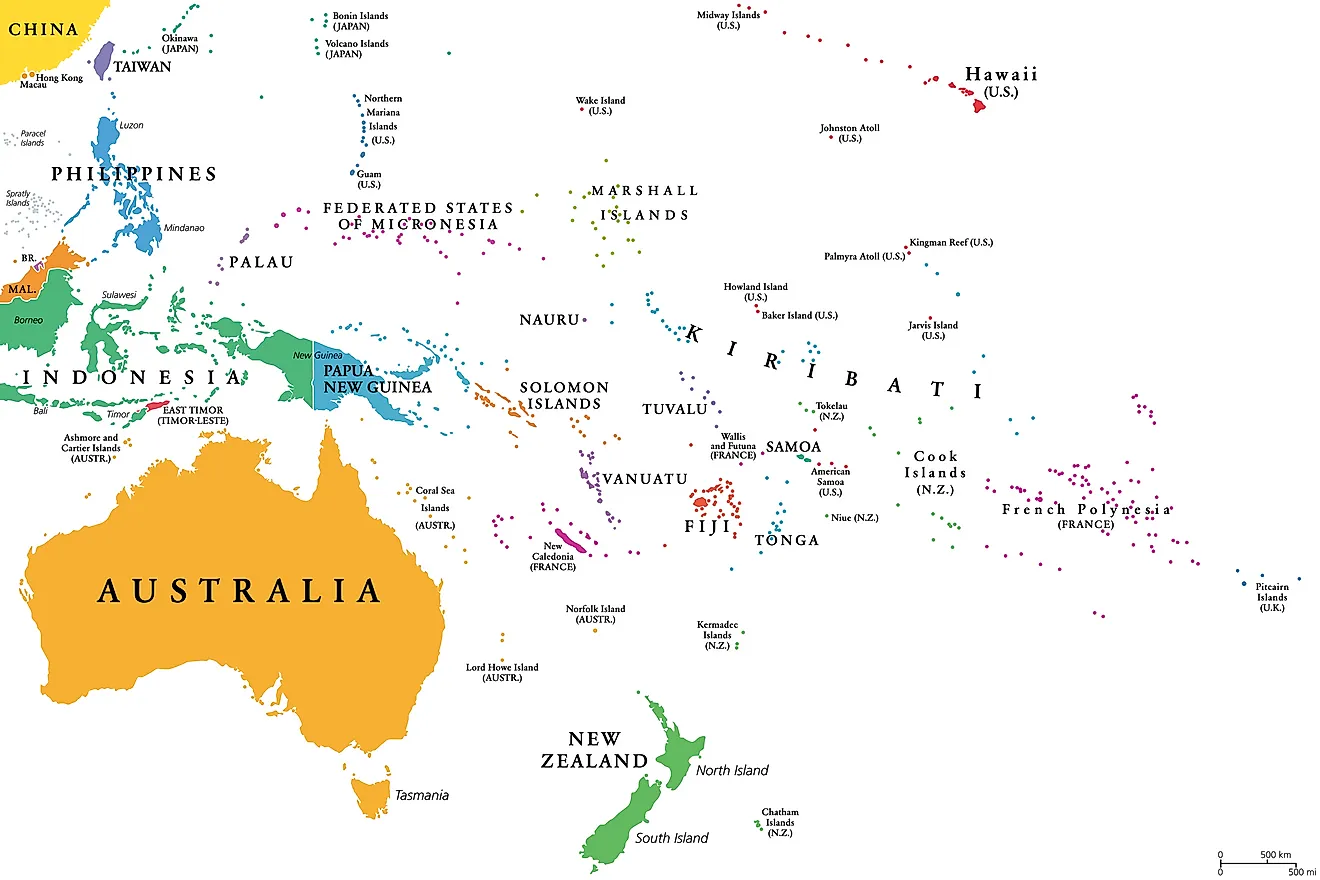
Wake Island, which covers an area of between 2.5 and 2.73 square miles, is located in the Micronesia subregion of the Pacific Ocean. This island serves as a refueling point and emergency airport for the US Air Force, which also manages the area. In addition, Wake Island is used a launch site for US missiles. It is inhabited by around 94 military personnel, who work for the Missile Defense Agency, the Army Space and Missile Defense Command, and the Air Force. Its location is far from permanent human settlements; Utirik Atoll of the Marshall Islands is the nearest inhabited island, 592 miles away.
6. Jarvis Island
Jarvis Island is located between the Cook Islands and Hawaii in the Pacific Ocean. This coral island measures only 2.026 miles long and 1.379 miles wide. It is considered a tropical desert climate and has no freshwater, able to support only a few grass and shrub species. Research indicates that it has never hosted a permanent human settlement. The American Guano Company laid claim to this territory in 1857 under the Guano Islands Act and exported its guano to the US for 21 years. From 1889 until 1935, it was considered a British territory. In 1935, the US government reestablished ownership and attempted to colonize the island. Its 4 colonists were evacuated during World War II, the infrastructure was destroyed, and the Japanese bombed the landing field. Today, it is part of the Pacific Remote Islands Marine National Monument.
5. Palmyra Atoll
The Palmyra Atoll is located 3,400 miles from any continent and sits in the middle of the Pacific Ocean. It is managed by the US Fish and Wildlife Service as a National Wildlife Refuge. During World War II, a non-native rat population was introduced to the island and caused significant damage until 2012, when it was successfully eradicated. Eradication efforts, however, left behind toxic residues that have been found in 84.3% of all species samples taken. The long-term effects of these toxins have not been studied. This atoll does not have a permanent human settlement although between 4 and 25 employees of the Nature Conservancy, Inc. and the US federal government can be found here at any given time.
4. Johnston Atoll
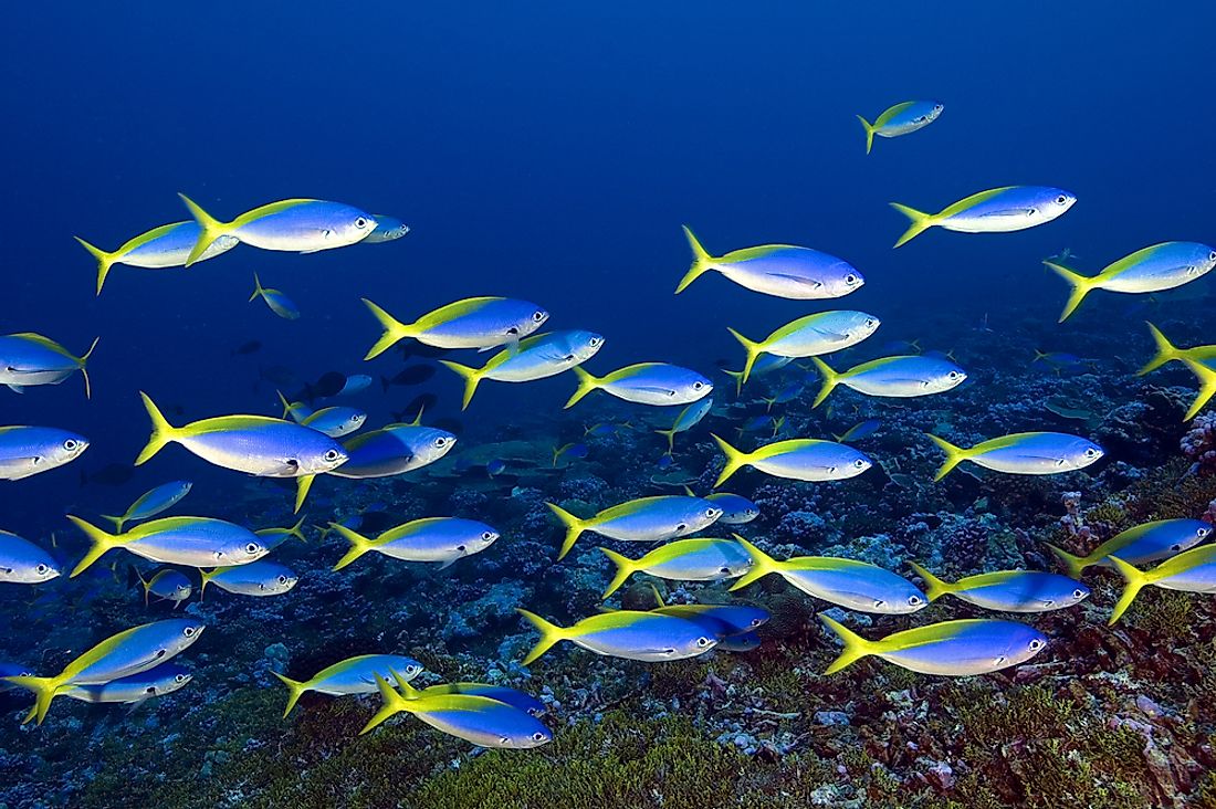
The Johnston Atoll is located in the Pacific Ocean, 860 miles from Hawaii. Like many of the islands on this list, the US government claimed it as a territory under the Guano Islands Act. From 1934 to 2004, this atoll was under the administration of the US Navy and used as a strategic naval defense zone. The US Fish and Wildlife Service sent a biologist and wildlife refuge manager to the island in 1990, in order to manage and reverse the environmental damage caused by its military use. The waters surrounding this territory are home to approximately 300 fish species.
3. Baker Island
Baker Island covers an area of less than 1 square mile. For nearly 2 decades in the late 19th century, the American Guano Company mined this island for guano before selling the rights to a British company, In 1936, the US government reclaimed the territory under the American Equatorial Islands Colonization Project. The four colonists living here as part of the project were evacuated during World War II. Today, it is part of the Baker Island National Wildlife Refuge and managed by the US Fish and Wildlife Service.
2. Howland Island
Howland Island is located between Hawaii and Australia in the Pacific Ocean. Archaeologists have discovered the remains of ancient Polynesian settlements here. The island has, however, been long uninhabited due to its lack of freshwater and inability to support a sustainable human population. It was mined by both the United States and American Guano Companies until 1878 and in 1936, became the site of a US colonization attempt, which was abandoned during World War II. Today, the island is administered by the US Fish and Wildlife Service as a National Wildlife Refuge.
1. Kingman Reef
Kingman Reef is a tiny territory, comprised of .01 square miles of dry land surrounding a 270-foot deep lagoon. Its highest elevation is only 5 feet above water and spends most of its time submerged. This territory is considered dangerous to ships and other water vessels given its poor visibility. It was briefly used as a resting area for flying boats traveling between American Samoa and Hawaii by Pan American Airways. During World War II, it was established as a naval defensive area. In 2000, Kingman Reef became a National Wildlife Refuge, administered by the US Fish and Wildlife Service. It is home to 130 coral species and a large population of sharks. Additionally, green sea turtles often search this coral reef for food.
The Most Isolated, Uninhabited (Or Least Inhabited) Territories Of The US
| Rank | Territory | Acquired | Territorial status | Land area in square miles |
|---|---|---|---|---|
| 1 | Navassa Island | 1858 | Unincorporated, unorganized | 3 |
| 2 | Midway Atoll | 1867 | Unincorporated, unorganized | 3 |
| 3 | Wake Island | 1899 | Unincorporated, unorganized | 2.5 |
| 4 | Jarvis Island | 1856 | Unincorporated, unorganized | 2.2 |
| 5 | Palmyra Atoll | 1898 | Incorporated, unorganized | 1.5 |
| 6 | Johnston Atoll | 1859 | Unincorporated, unorganized | 1 |
| 7 | Baker Island | 1856 | Unincorporated, unorganized | 0.9 |
| 8 | Howland Island | 1858 | Unincorporated, unorganized | 0.6 |
| 9 | Kingman Reef | 1860 | Unincorporated, unorganized | 0.01 |