Biggest Islands In The Solomon Islands Archipelago
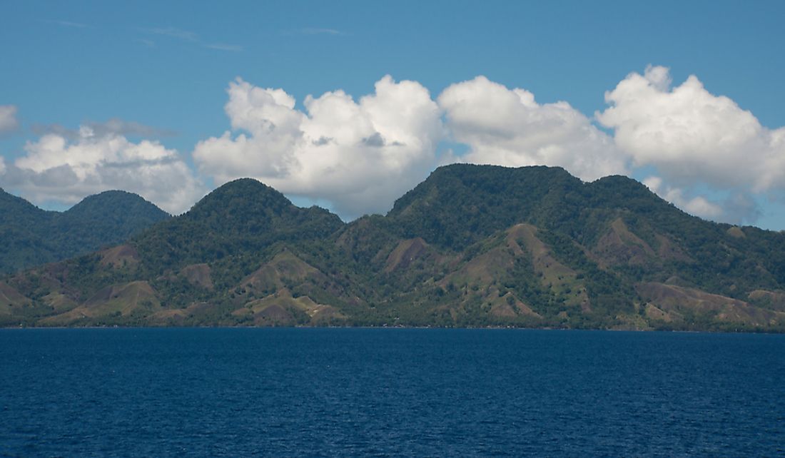
The Solomon Islands are an archipelago located in the South Pacific Ocean. The archipelago is made up of several large islands and over 900 smaller islands, including volcanic and coral atolls. The islands of the archipelago are shared by the two nations; Papua New Guinea controls the largest island, Bougainville, while the Solomon Islands control most of the rest. These islands experience a tropical climate and monsoon season from November to March. Geographic characteristics range from mountains to rainforests to beaches. The biggest of these islands is discussed below.
Bougainville
Also known as North Solomons, Bougainville is the largest island of the Solomon Islands archipelago covering 3,591 sq miles. It is the main island of Papua New Guinea's Autonomous Region of Bougainville. The island was settled about 28,000 years ago and today has a population of 234,280 as of 2011. Although Bourgainville is separated from the nearby island of Buka by a deep strait, the two are considered a single landmass. Mount Bagana is the highest point on the island and spews smoke that can be seen from several kilometers away. Earthquakes are common through they usually cause little damage. The island's biggest threat is deforestation as land is cleared to feed the growing population.
Guadalcanal
The Guadalcanal island encompasses an area of 2,047 square miles and is the main island of the Solomon Islands nation. The population here is approximately 109,382. Traditional farming methods are still employed here such as the slash and burn technique to cultivate crops such as yaro and sweet potato. Inland households typically raise pigs while coastal inhabitants rely on fishing. During World War II, Japanese and US troops fought over the island for several weeks. The Japanese were eventually driven out. Today, visitors can still see old war relics. The only mammals on this island are bats, rodents, and the native grey cuscus. Many more bird species make their home here. Mount Makarakomburu is the second highest point on the island reaching 7,580 ft.
Malaita
Malaita island is made up of 1,663 square miles of land area. Approximately 130,909 people share the space divided between the capital, Auki, and the inland regions, referred to as the bush. The most commonly used languages here come from the Malaitian language family. Traditionally, and still practiced today, land ownership is determined through a person’s family lineage. Subsistence agriculture plays an important part of the economy and typical crops include taro and sweet potato. Several ecological habitats can be found across the island depending on elevation. In all of these habitats, reptiles and amphibians are more common than mammals. The Malaita fantail bird is endemic to the island.
Santa Isabel
The fourth biggest island in the Solomon Islands archipelago is Santa Isabel. Part of the Isabel Province, this island has a land area of 1,158 square miles. The population is estimated to be around 26,158. Natives of the island were first contacted by Europeans in 1568 when Spaniards established a town. After their search for gold proved unsuccessful, the Spaniards abandoned Santa Isabel and established a settlement on the island of Guadalcanal. Approximately 8 tribal languages are spoken here in addition to English and Solomon Islands Pijin.
Biggest Islands In The Solomon Islands Archipelago
| Rank | Biggest Islands in the Solomon Islands Archipelago | Land Area |
|---|---|---|
| 1 | Bougainville (Papua New Guinea) | 3,598 square miles |
| 2 | Guadalcanal | 2,047 square miles |
| 3 | Malaita | 1,663 square miles |
| 4 | Santa isabel | 1,158 square miles |
| 5 | Choiseul | 1,147 square miles |
| 6 | New Georgia | 786 square miles |
| 7 | Rennell | 255 square miles |
| 8 | Buka (Papua New Guinea) | 190 square miles |
| 9 | South Malaita | 186 square miles |