Where is Kamina, The Democratic Republic Of The Congo?
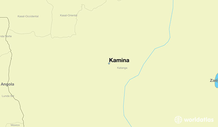
Kamina is a city found in Katanga, The Democratic Republic Of The Congo. It is located -8.74 latitude and 25.00 longitude and it is situated at elevation 1124 meters above sea level.
Kamina has a population of 73,557 making it the 5th biggest city in Katanga. It operates on the CAT time zone, which means that it follows the same time zone as Lubumbashi.
Quick facts
| Country | The Democratic Republic Of The Congo |
| Province | Katanga |
| Population | 73,557 |
| Elevation | 1,124 m over sea level |
| Time Zone | CAT |
| Longitude | 24.997980 |
| Latitude | -8.735080 |
This page was last updated on October 2, 2015.